

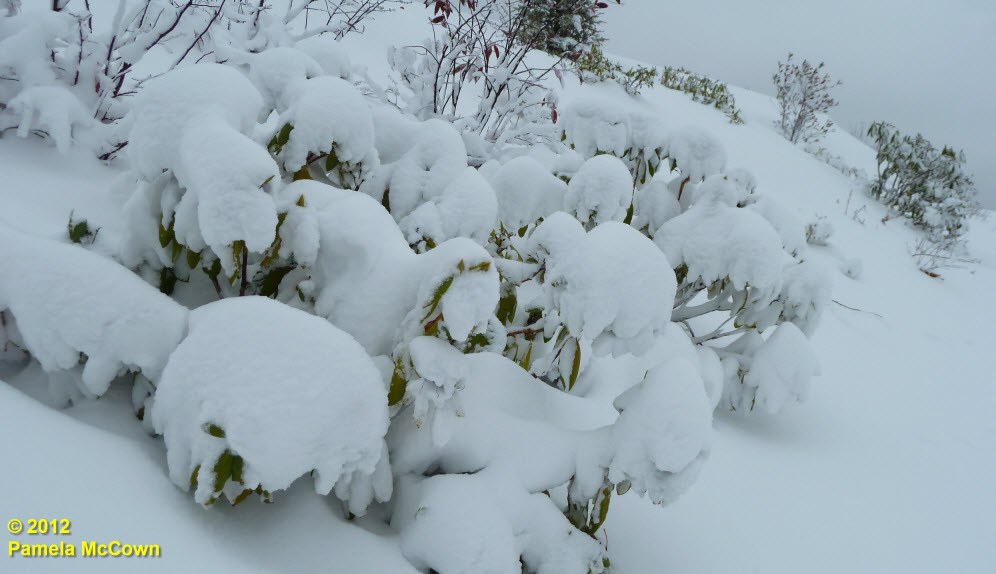
The snow that fell in Western North Carolina this week due to Hurricane Sandy was mainly isolated to the higher elevations, and unless you’ve been up in the mountains in the last couple of days, it’s hard to appreciate just how much snow the area received.
Author: Pamela McCown
Showing 22-42 of 50 results
My, how things change: The weather
One of the most amazing things about living in Western North Carolina is the ability to watch the Earth system move through its annual climate cycles. That is especially true for those of us who have moved here from other regions, especially those that, perhaps, do not progress through these cycles in such grand fashion.
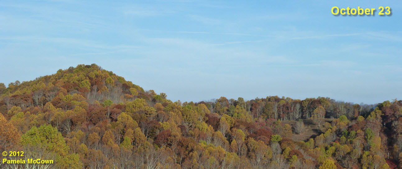
The images below highlight how fast the changes occur in our mountains. Frozen Knob is a mountain in Madison County that shows great color each fall. Color had just started to appear on the mountain on October 11th, but by this week, the greens are giving way to the yellows, oranges and rusts of fall.
>
Nature’s fall color palette and a meteor shower this weekend
For those of us who consider ourselves to be “visual” people, fall can be simply overwhelming. Everywhere we look, there’s something else that takes our breath away.
Inversion and balloons (much better than inverted balloons)
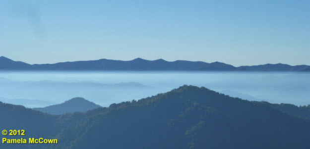
Fall brings many changes to Western North Carolina, from the turning of the leaves to the turning up of the thermostat. These cooler nights mean that many of us are heating our homes with wood-burning stoves and fireplaces to ward off the chill. Most of the time, the wood smoke (along with other particulates that are in the air) mix through much of the lowest layer of our atmosphere, called the troposphere. But when the air is cool and the winds are calm, we can occasionally see those tiny particles concentrated in the early morning air under what meteorologists call a radiational temperature inversion. Such was the case this morning, as you can see in the image below from Madison County, looking to the southeast across the valley toward the Craggies (image center) and the Blue Ridge Parkway.
Early fall color at the higher elevations
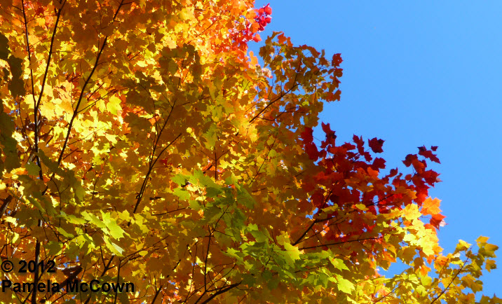
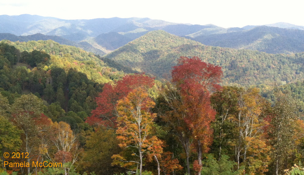
It really is a magical time of the year, as our once deep-green mountainsides begin to show their fall color. The reduced daylight hours have triggered the deciduous trees’ preparation for the coming winter and, at times, it seems like the changes happen so quickly that you can see them occur overnight. I took this image Thursday morning — amazed at just how fast these trees seem to be changing.
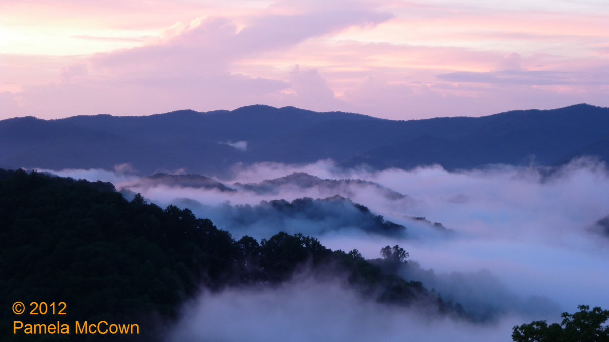
Fog: Does that mean WNC will have snowy winter days?
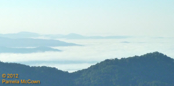
Fog has been a common morning feature across the valleys in Western North Carolina for much of the summer and early fall. And while fog causes concern for travel because it reduces visibility, could it also be possible that the fog may be warning us of the coming winter?
Lots of water
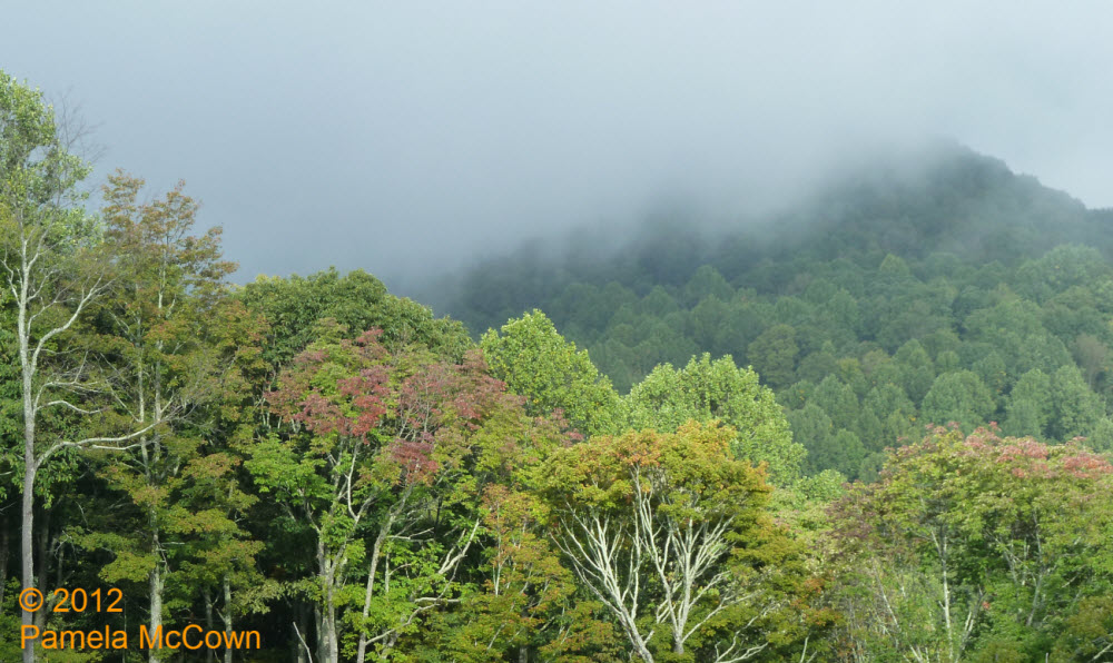
The beginning of this week started with significant rainfall over the region thanks to a large weather system that dumped a record amount of rainfall in Asheville on Tuesday, Sept. 18, and provided more rain in two days than we usually expect during the entire month of September! Our area’s rivers and streams are doing their job of transporting that water downstream — but the evidence of all that moisture was still hanging around early this morning in the form of low clouds. I shot the image below earlier today as the clouds were beginning to break at 4000 feet — revealing the early fall color that is starting to appear on ridgetops.
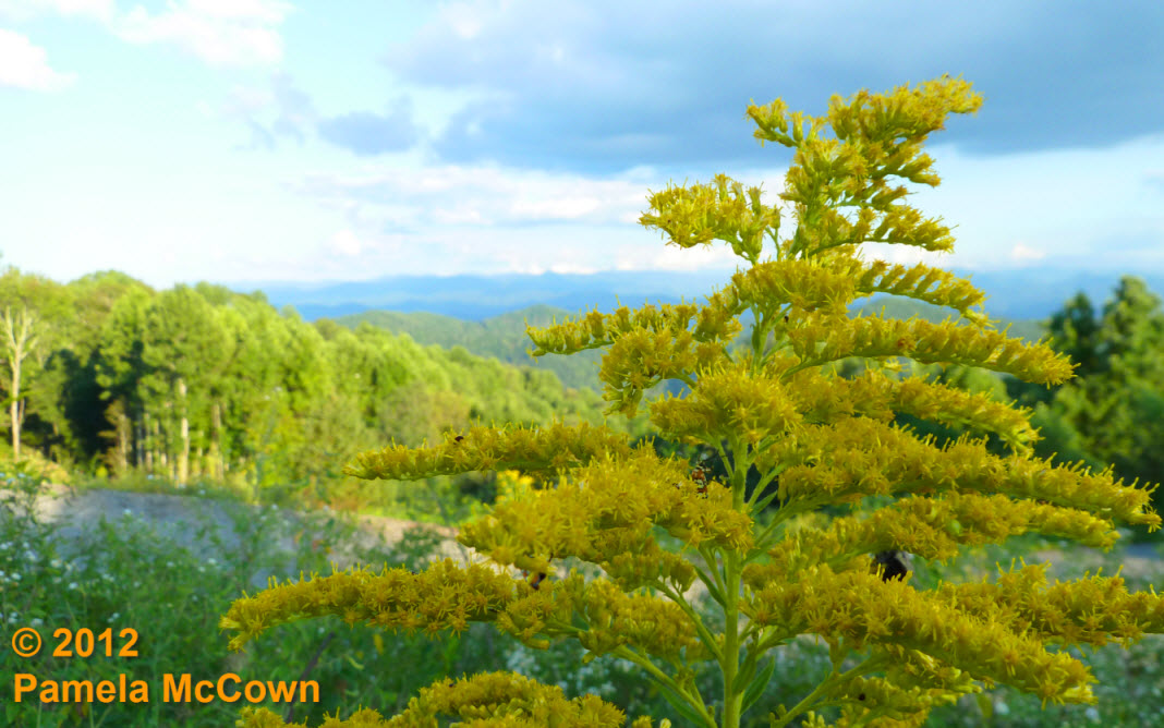
The first sign of coming change
The bright yellows of Goldenrod are now plentiful in fields and along roadways in Western North Carolina; last weekend’s cold front brought cooler and drier air into the region; and you may have noticed that some of the leaves on the trees are beginning to lose their deep green color. These first signs of the coming autumn are a welcome sight to many of us who claim fall to be our favorite season.
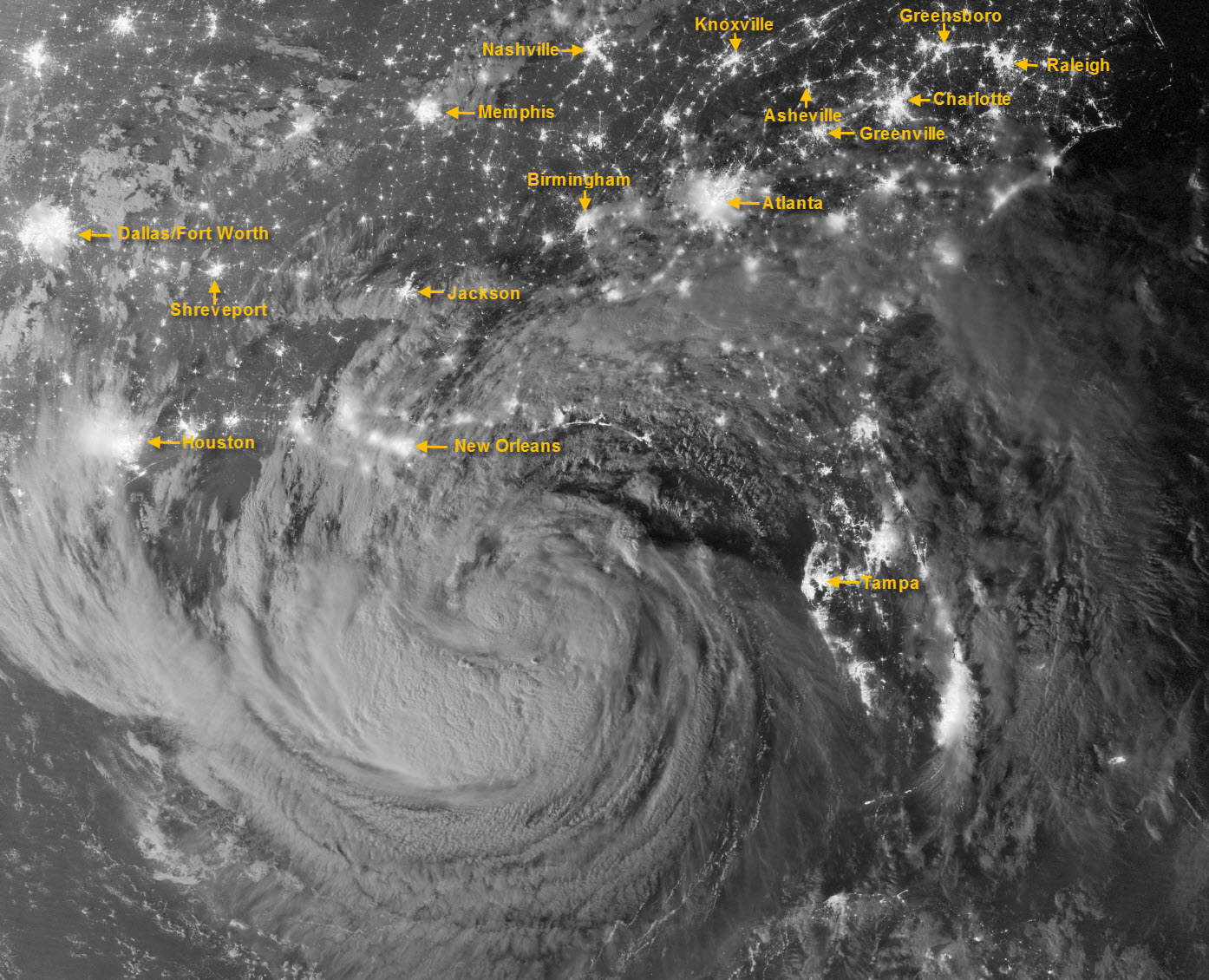
Isaac takes the coast by storm (at night!)
This amazing image of Tropical Storm Isaac was captured just after midnight on Tuesday, Aug. 28, by the Visible Infrared Imaging Radiometer Suite (VIIRS) on the Suomi-NPP satellite. Still off the Gulf Coast, Isaac’s clouds were lit by moonlight and the lights of cities across the Southeast U.S. are clearly visible. I’ve added labels for some of the more visible metropolitan areas, including Asheville.
The lush forests of Western North Carolina
The forests that blanket Western North Carolina go through a yearly cycle of growth that can often occur unnoticed by most of us until we see the colorful displays of leaves in the fall … or have to fight the non-stop weeds of August. The ever-watchful eyes of NASA’s Earth Observing System makes it possible for us to appreciate this annual growth cycle from a new vantage point, thanks to the MODIS (or Moderate Resolution Imaging Spectroradiometer) instrument aboard the Aqua and Terra satellites.
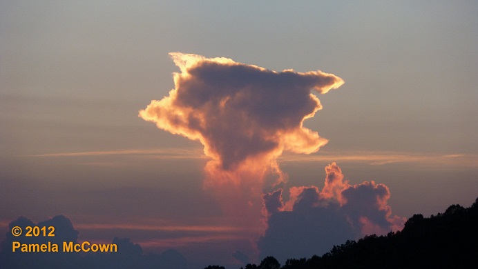
It’s the summer of the Haves and the Have Nots – with a meteor shower to boot
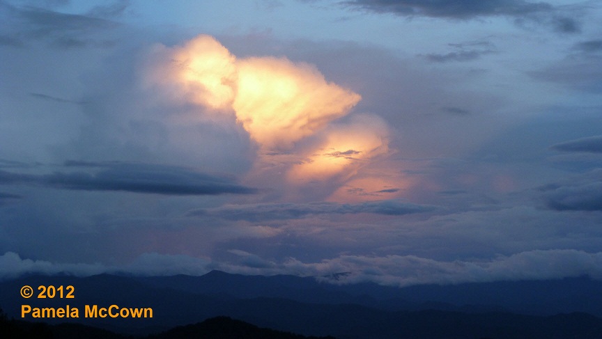
The story of this summer has certainly been that of climate extremes. In Western North Carolina, we’ve had quite a bit of rain, while well over half of the lower 48 states remain in drought. Our moist summer has produced jungle-like conditions in many of our yards (errr — maybe just mine), but has also produced some breathtaking sunsets with all the moisture in the air.
The mysterious disappearing rain
The scattered thunderstorms this week have created several opportunities to witness a weather phenomenon that you may have seen a number of times, but didn’t quite know what to call it.
A stormy pattern – but so much better than the alternative
It’s hard to overstate the importance of water to the Earth’s climate system. In its three phases — liquid, solid and gas — water helps to drive our local weather as well as our regional climate. Most of us don’t think about plain ol’ water too often, but it’s when we have too much or too little of this precious resource that we really pay attention to it.
When it rains, it pours (at least for some)
The stalled frontal boundary that is lingering over the Southeast U.S. has provided some much needed rainfall from Texas to the Atlantic Ocean — but some folks in Western North Carolina saw too much of a good thing on Wednesday, July 11, when more than 3 inches of rain fell in areas of both Buncombe and Madison Counties.
The reason for the seasons
On June 20 at 7:09 p.m. EDT, we officially entered summer as people across the Northern Hemisphere noted the summer solstice. This event occurs at when the Earth’s northern axis is at its greatest tilt toward the Sun. It is because our planet is tilted on its axis of rotation by about 23.5 degrees that we experience seasons.
Venus in transit: A rare event gives us some perspective
Life is crazy, busy, I know. We get so focused on daily activities that we often forget what a wondrous and amazingly large universe we live in. Occasionally, we get a glimpse of that reality and it never fails to leave us awestruck. Such was the case on June 5, when we were treated to a rare event during which we were able to see one of the two inner planets of our solar system, Venus in this case, pass in front of our Sun, an event called a transit. ![]()
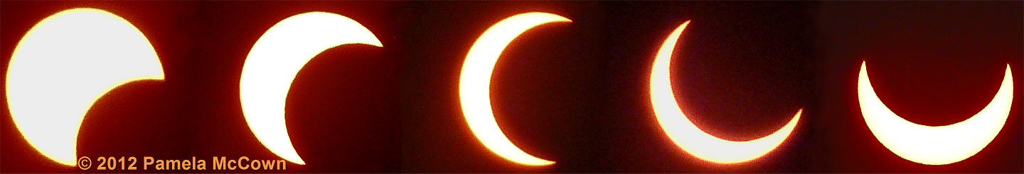
Solar eclipse – special delivery to Asheville
A fascinating spectacle occurred on Sunday, May 20, but only viewers in the Western and Central U.S. were treated to the rare annular solar eclipse that evening. Fortunately, I was able to capture it as I was visiting the West Coast on vacation.
Solar pillar and contrails . . . Oh My!
Last week: Western North Carolina enjoyed some beautiful weather since the rain moved out on Wednesday, May 9. Those mostly clear skies set the stage for a beautiful sunset on Thursday, evening, May 10 — with some atmospheric optics to boot!

The greening of the mountains
One of the most amazing transformations in nature is on display right here in Western North Carolina as trees and vegetation come alive in the spring.
Late-April snow? It’s spring in WNC
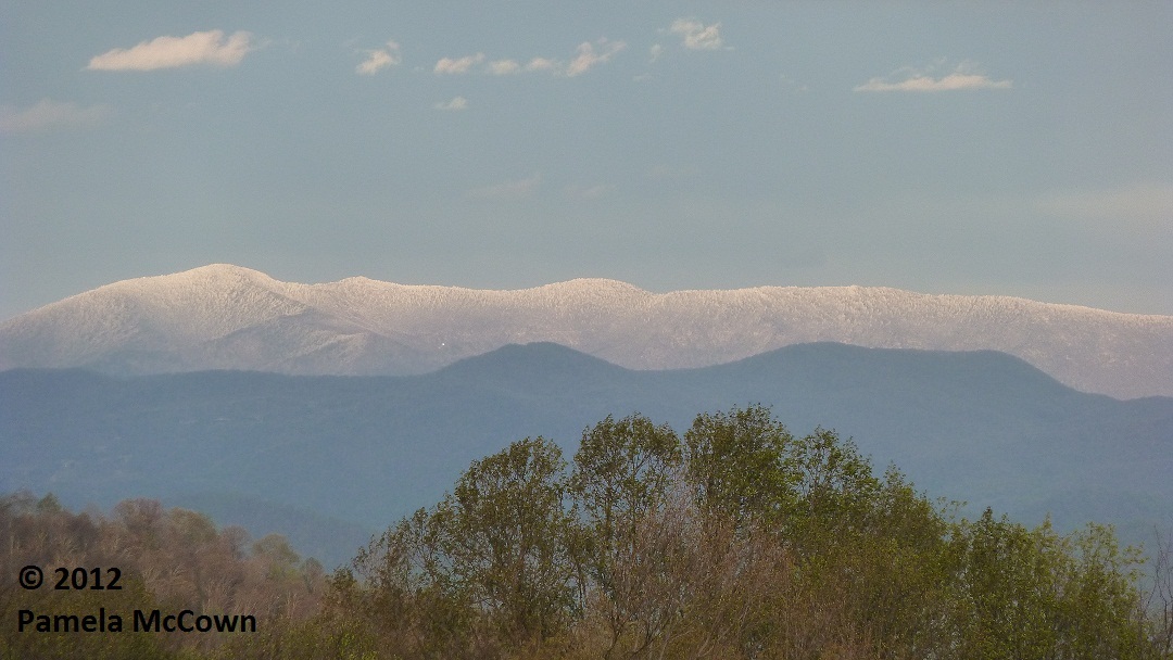
While snow in April is not unheard of in Western North Carolina – this past weekend’s snow event seemed out of place, partly because
we had such a warm March this year.
Spring storms create a foggy morning
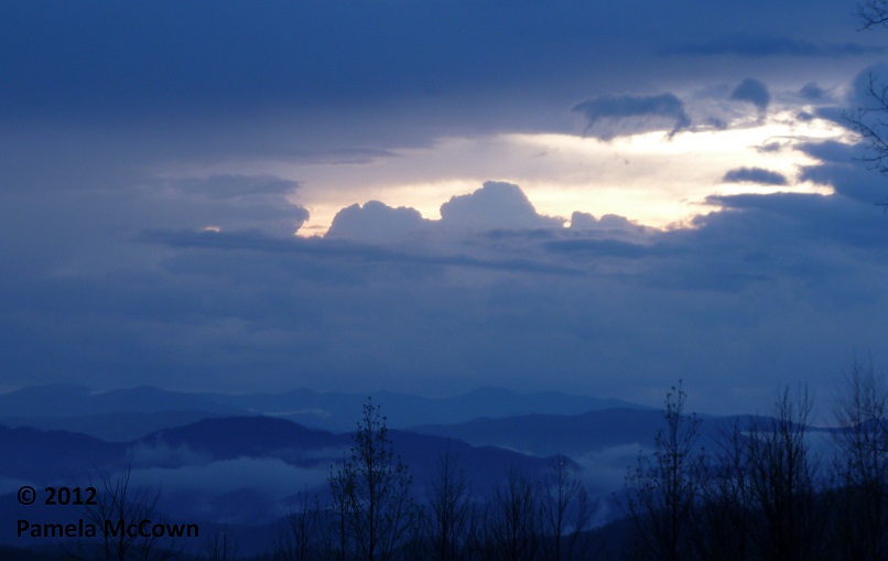
Spring brings the return of afternoon thunderstorms, but the impact of the rain can last long after the storms move on.