


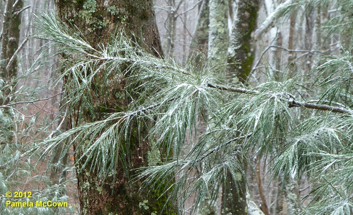
From the Institute for Climate Education at A-B Tech: The month of December had been off to a warm start in Western North Carolina, with the average temperature in Asheville for the first 10 days of the month reported at 10.2° F above normal. However, Monday night’s cold front brought an end to the warmth. It is feeling like the holiday season has finally arrived — even bringing some light snow to the higher elevations in WNC. The image below shows a light dusting of fine snow on a white pine at 4,000 ft in Madison County on Tuesday morning, Dec. 11.
In addition to the colder air, the latest weather system also brought some much needed rainfall. The image below shows the recent rainfall across the region, with most of French Broad River Valley receiving less than 1/2 inch. The scale to the right shows the amount of rain indicated by each color, and you’ll notice that most of the rain fell in the higher elevations west of Asheville.
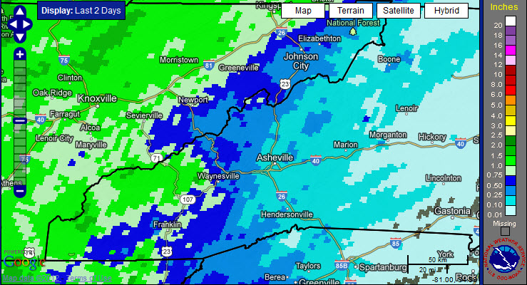
Image Credit: NOAA’s National Weather Service generated using the National Weather Service’s radar and rain gauge data combined.
Last month was very dry over almost all of North Carolina. Statewide, it was the 7th driest November on record (since 1895), according to the Climate Summary by the State Climate Office of North Carolina.
December has been dry as well: Even with the addition of recent rain, Asheville is over an inch below normal for the month and is 2.75 inches below normal rainfall for the year, so far.
While it has been dry, much of WNC has been able to escape the designation of drought, instead being labeled as “abnormally dry,” as you can see in the yellow shaded areas in the U.S. Drought Monitor below. However, some of WNC’s southern counties have been upgraded to Moderate Drought (shaded in tan).
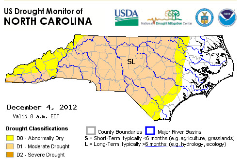
Image Credit: US Drought Monitor through the NC Drought Management Advisory Council
The good news is that the long term outlook from NOAA’s Climate Prediction Center indicates that our chances for precipitation are better than usual for the next 10 days, and our local forecast calls for a slight chance for rain over the weekend and early next week providing some opportunities to help us add some additional rain into the rain gauges.
Before you comment
The comments section is here to provide a platform for civil dialogue on the issues we face together as a local community. Xpress is committed to offering this platform for all voices, but when the tone of the discussion gets nasty or strays off topic, we believe many people choose not to participate. Xpress editors are determined to moderate comments to ensure a constructive interchange is maintained. All comments judged not to be in keeping with the spirit of civil discourse will be removed and repeat violators will be banned. See here for our terms of service. Thank you for being part of this effort to promote respectful discussion.