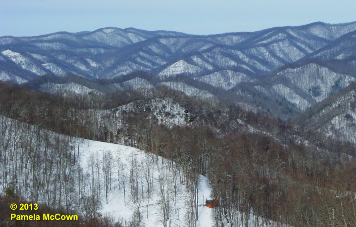
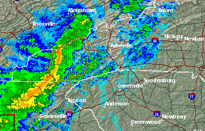
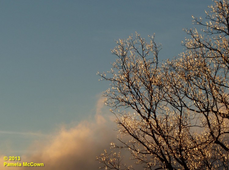
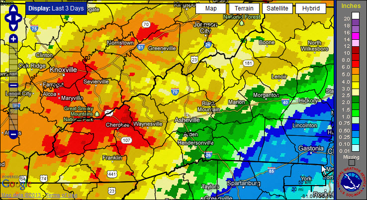
Winter is about to arrive

After three days of rain, many locations in Western North Carolina have reported significant rainfall. Now, the larger-scale weather pattern appears to be shifting into a more winter-like pattern for the Eastern U.S., with a significant winter storm expected later today and arctic air moving in over the weekend. So, hold on: It looks like it’s going to be a bumpy ride!

Tomorrow never knows: WNC disasters past, present and future


Even as the holidays come barreling toward us, some folks around the globe fear the mythical planet Nibiru may be doing the same and will trigger some unspecified cataclysm on Dec. 21. Notwithstanding the supposed end of the Mayan calendar, however, local agencies seem focused on preparing for more realistic potential threats. Although it may not be the end of the world, Western North Carolina does remain vulnerable to a wide range of natural and human-made catastrophes, including floods, blizzards, fires and even nuclear accidents.

Asheville area readies for winter storm ***UPDATED 9 a.m.***

This morning, it’s icy rain in Asheville, while some mountain counties are reporting 6 inches of snow — one consequence of Sandy, the massive storm battering the East Coast. The National Weather Service has issued a winter storm warning for Western North Carolina, including Buncombe County, until 6 a.m. Wednesday, Oct. 31. Gov. Bev Perdue has declared a state of emergency throughout WNC. (Photo by Bill Rhodes)

Where is winter? Look to the polar vortex


Snowflakes were flying earlier this week, as Valentine’s Day started off white at the higher elevations.

Snowflakes were flying earlier this week, as Valentine’s Day started off white at the higher elevations.  This image of Max Patch in western Madison County shows the short-lived snow.  So – what has happened to this winter? Why has it been so different than the last two years?