


The National Weather Service has issued a Winter Storm Warning for the Asheville area until midnight tonight, predicting two to five inches in the lower valleys and six to 10 at higher elevations.
Tag: weather
Showing 64-84 of 109 results
Winter Storm Watch for Asheville area, 3-6 inches of snow expected tomorrow
The National Weather Service has issued a Winter Storm Watch for Buncombe, Haywood, and Madison counties starting tomorrow morning. The notice cautions residents about the possibility of a “significant winter storm” tomorrow.
Watch out for wind, winter weather throughout WNC
The National Weather Service has issued a winter weather advisory for the northern part of WNC, including Madison County. The NWS has also issued a wind advisory for the Asheville area, cautioning residents to watch out for downed trees and difficult driving conditions.
National Weather Service: ‘High Wind Warning’ for Buncombe County
The National Weather Service has issued a “High Wind Warning” for much of Western North Carolina, including Buncombe County.

Thousands without power in WNC after wind takes out trees
It was a cold, dark first night of winter for many in our region, as high winds took out power all over Western North Caroilna. (pictured: a Progress Energy lineman working to restore power in 2010; photo by Bill Rhodes)
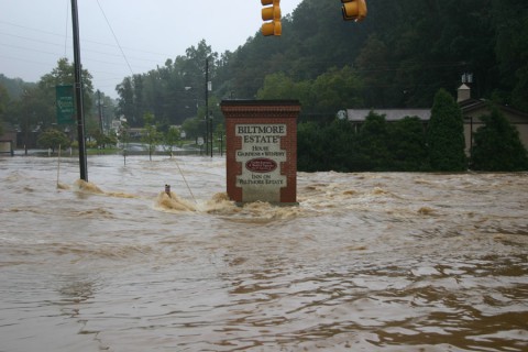
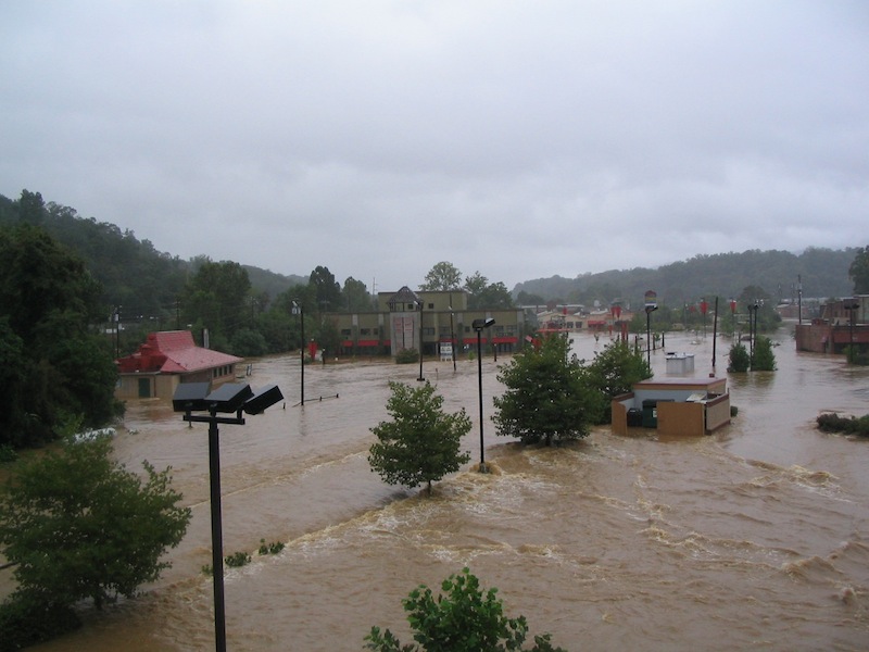
Disaster 2012 Web Extra: Remembering the 2004 floods
With speculation rampant across the world over the possibility of a mysterious cataclysmic event occurring tomorrow, Dec. 21 in conjunction with the supposed end of the Mayan calendar, Xpress took a look at more realistic local threats this week in the story “Tomorrow Never Knows: WNC Disasters Past, Present and Future.” As part of our research for that story, we compiled several photos from one of the biggest natural disasters to strike our region in modern history – the floods of 2004.

Tomorrow never knows: WNC disasters past, present and future


Even as the holidays come barreling toward us, some folks around the globe fear the mythical planet Nibiru may be doing the same and will trigger some unspecified cataclysm on Dec. 21. Notwithstanding the supposed end of the Mayan calendar, however, local agencies seem focused on preparing for more realistic potential threats. Although it may not be the end of the world, Western North Carolina does remain vulnerable to a wide range of natural and human-made catastrophes, including floods, blizzards, fires and even nuclear accidents.

Asheville area readies for winter storm ***UPDATED 9 a.m.***
This morning, it’s icy rain in Asheville, while some mountain counties are reporting 6 inches of snow — one consequence of Sandy, the massive storm battering the East Coast. The National Weather Service has issued a winter storm warning for Western North Carolina, including Buncombe County, until 6 a.m. Wednesday, Oct. 31. Gov. Bev Perdue has declared a state of emergency throughout WNC. (Photo by Bill Rhodes)
Lots of water
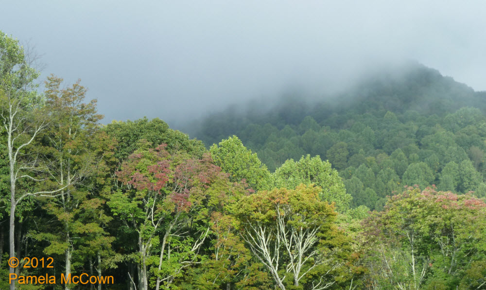
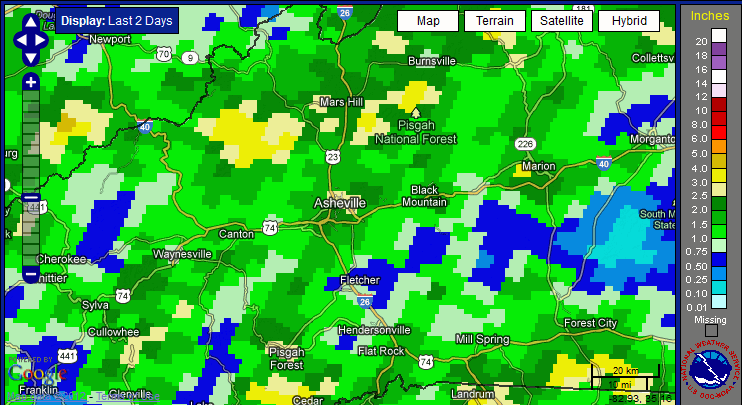
The beginning of this week started with significant rainfall over the region thanks to a large weather system that dumped a record amount of rainfall in Asheville on Tuesday, Sept. 18, and provided more rain in two days than we usually expect during the entire month of September! Our area’s rivers and streams are doing their job of transporting that water downstream — but the evidence of all that moisture was still hanging around early this morning in the form of low clouds. I shot the image below earlier today as the clouds were beginning to break at 4000 feet — revealing the early fall color that is starting to appear on ridgetops.
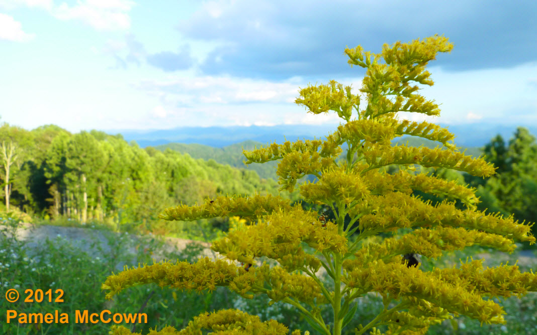
The first sign of coming change
The bright yellows of Goldenrod are now plentiful in fields and along roadways in Western North Carolina; last weekend’s cold front brought cooler and drier air into the region; and you may have noticed that some of the leaves on the trees are beginning to lose their deep green color. These first signs of the coming autumn are a welcome sight to many of us who claim fall to be our favorite season.
The lush forests of Western North Carolina
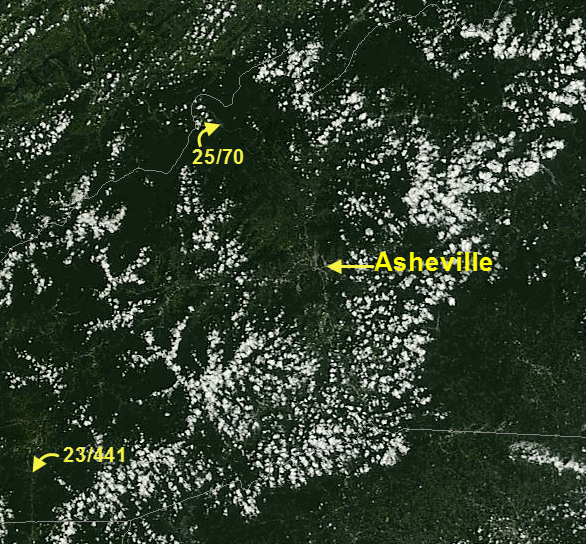
The forests that blanket Western North Carolina go through a yearly cycle of growth that can often occur unnoticed by most of us until we see the colorful displays of leaves in the fall … or have to fight the non-stop weeds of August. The ever-watchful eyes of NASA’s Earth Observing System makes it possible for us to appreciate this annual growth cycle from a new vantage point, thanks to the MODIS (or Moderate Resolution Imaging Spectroradiometer) instrument aboard the Aqua and Terra satellites.
Commissioners declare state of emergency due to flood risk in Leicester UPDATED
UPDATE: The Asheville Citizen-Times reports that a failed retention pond in the Serenity Forest area off New Leicester Highway “prompted the evacuation of three homes and damaged a nearby road.”
When it rains, it pours (at least for some)
The stalled frontal boundary that is lingering over the Southeast U.S. has provided some much needed rainfall from Texas to the Atlantic Ocean — but some folks in Western North Carolina saw too much of a good thing on Wednesday, July 11, when more than 3 inches of rain fell in areas of both Buncombe and Madison Counties.

A look at the July 11 downpour through Storify
As the rain fell, Xpress reporter Caitlin Byrd aggregated tweets, photos and video taken of the July 11 rain in Asheville by using Storify. (photo by Bill Rhodes)
Become an official severe-weather spotter: Local institute offers June 2 Skywarn training
A-B Tech Community College’s Institute for Climate Education is sponsoring a free severe weather workshop that includes National Weather Service training for volunteers interested in becoming Skywarn spotters.
Solar pillar and contrails . . . Oh My!
Last week: Western North Carolina enjoyed some beautiful weather since the rain moved out on Wednesday, May 9. Those mostly clear skies set the stage for a beautiful sunset on Thursday, evening, May 10 — with some atmospheric optics to boot!

Late-April snow? It’s spring in WNC
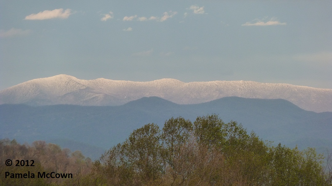
While snow in April is not unheard of in Western North Carolina – this past weekend’s snow event seemed out of place, partly because
we had such a warm March this year.
Spring has sprung!
As we woke up this week to the vernal equinox and the first full, official day of spring, many across Western North Carolina are dealing with an early spring that seems to have gone haywire.
Spring’s scattered thunderstorms return to the mountains
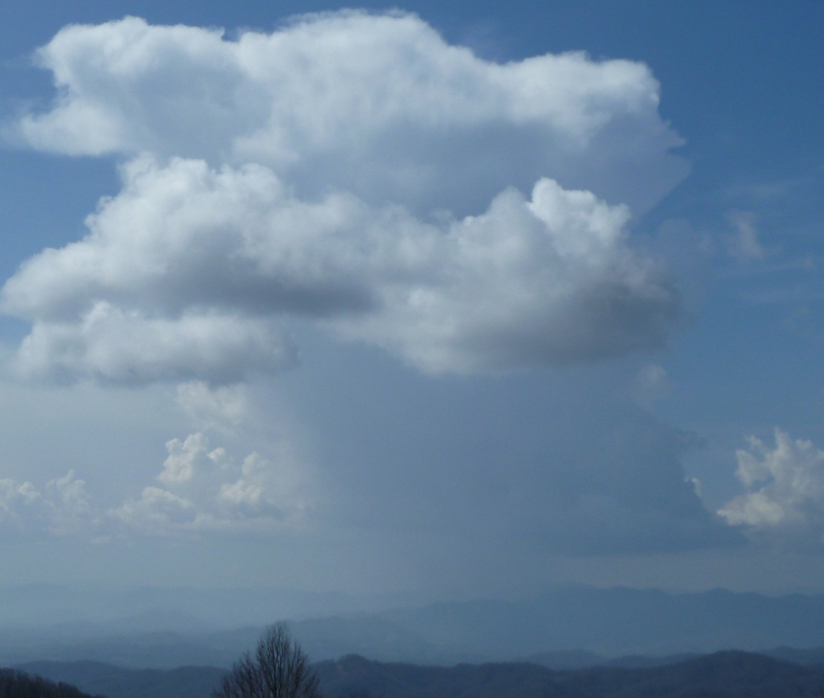
For many of us in the mountains, it seems that spring has sprung almost overnight as trees are flowering, birds are singing and allergies have hit full force (cough, cough). Another sure sign of spring: Scattered thunderstorms that pop up in the heat of the sun.

First mowing of the season
You know once you finally realize the grass is not going to mow its self, get the mower to start, start pushing through the tall grass and onions — yeah, it was that kind of day.
The word of the season is . . . variability
As we say goodbye to February and hello to the coming spring — you’ll notice how changes to our environment seem to happen very quickly this time of year.