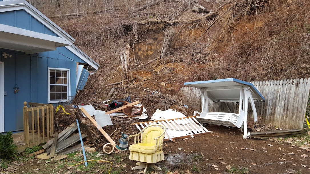
Press release from Appalachian Landslide Consultants:
The recent heavy rains and accompanying landslides are a harsh reminder that landslides are a part of living in mountainous Jackson County. Jackson County has teamed with a local landslide mapping consulting firm to learn more about the landslides that affect the county and what areas may be more prone to landslides in the future. This project will provide information to the citizens of Jackson County so they will be more aware of the hazards and can be proactive in preventing or avoiding them.
Jackson County has contracted Appalachian Landslide Consultants, PLLC (ALC) to map landslides and landslide prone areas throughout the county. Jennifer Bauer and Stephen Fuemmeler, geologists and co-owners of ALC, will begin their field work this month. “It is encouraging to see Jackson County step up and tackle this problem on their own. We hope other counties that don’t have landslide maps will follow their lead to get this important information to the people who live here in the mountains of Western NC,” says Stephen Fuemmeler. Jennifer Bauer adds, “The maps are a tool to help citizens become more aware of landslides in the county and to make informed decisions when developing. When used properly, the maps will help people save money, save time, and maybe even save their lives.”
ALC will be driving many of the roads in the county looking for areas affected by landslides, both in the ancient past and from recent rains. They will be talking to landowners about any landslides they know about and asking permission to access property when needed. When they find landslides, they will collect data on the types of rocks, soil, and other slope characteristics that contributed to the landslide. This information will be used to help locate other areas that might be more prone to landslides in future heavy rain events.
ALC will also be assisting the Jackson County Emergency Management office with any landslide emergencies or safety concerns they have. Additionally, ALC will notify Jackson County EM if they find any slope stability issues that they feel could pose an immediate threat to life or property.
Public outreach and education is also an important component of this project. ALC has produced a brochure with information about the project, the mapping products, and landslides in Jackson County, which they will hand out to landowners they meet. They will also be creating a User’s Guide for the landslide inventory and susceptibility maps they produce. After the maps have been finalized, ALC will lead a workshop for interested users to learn how to use the online landslide map viewer.
The County is helping coordinate project stakeholders meetings with invited members who represent different sectors, regions, and organizations within Jackson County. The first of these meetings was held in January of this year. There are other community meetings throughout the project to follow in the coming year. The final stakeholders and community meetings will be held in the spring of 2017.
ALC anticipates field work lasting until the end of this year, and then computer modelling lasting through spring of 2017. The project will be completed by June 30, 2017. Please visit www.appalachianlandslide.com if you would like to learn more about landslides and landslide mapping.
Appalachian Landslide Consultants, PLLC is a geology consulting firm based in Asheville, NC. In addition to providing landslide mapping services, they also offer site specific characterization of landslides, property evaluations for real estate transactions, and consulting to those concerned about their slopes. Jennifer and Stephen have over 10 years each of experience mapping landslides in WNC. Both are licensed geologists.


Before you comment
The comments section is here to provide a platform for civil dialogue on the issues we face together as a local community. Xpress is committed to offering this platform for all voices, but when the tone of the discussion gets nasty or strays off topic, we believe many people choose not to participate. Xpress editors are determined to moderate comments to ensure a constructive interchange is maintained. All comments judged not to be in keeping with the spirit of civil discourse will be removed and repeat violators will be banned. See here for our terms of service. Thank you for being part of this effort to promote respectful discussion.