

Over my first Sunday cup of coffee, I spied clouds racing by against a blue sky, trees bowing in the morning wind, and I knew: Our long, hot summer had finally stepped aside for autumn. I ran to the bedroom and said to my husband: “You’ve got to see this. It’s so beautiful!”
Like a child counting the days until Christmas, I’d been tracking the weather patterns and picking out enticing trails for weeks. Now, at last, it was Appalachian fall, the hiker’s paradise. I could barely contain myself.
After a leisurely breakfast, we ambled out the door and drove to the trailhead for Sam Knob, 20 miles south of Asheville off the Blue Ridge Parkway, where a 6,050-foot bald near Cold Mountain boasts one of the best 360-degree panoramas in Western North Carolina.
The parking lot was full, but we managed to jiggle our way into a space and started looking for the trailhead. The sign for the Sam Knob Trail was missing so, 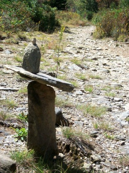 mindful of the search-and-rescue crew already hunting two lost hikers, we began our trek instead at the well-marked, orange-blazed Flat Laurel Creek Trail, which feeds into blue-blazed Sam Knob Trail. This easy path meanders over the creek several times and crosses an alpine meadow that reminded me of a visit to western Alberta more than a quarter-century ago.
The field below Sam Knob was lush with late-season wildflowers: lavender asters with honey centers, red clover, white Queen Anne’s lace and goldenrod shooting its flaming tips toward the sun. 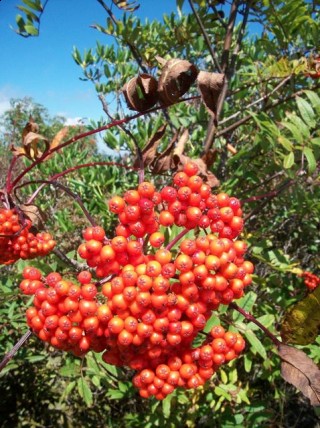 Bright-red elderberries, remarkably large and plentiful, decorated meadows and mountain slopes. I spotted wild blueberries at several points along the path, and one woman picking some.
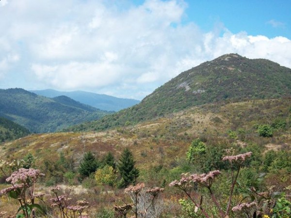
After rock-hopping over the creek several times and wandering through a valley filled with early fall blooms, we came to a clearly marked intersection, turned left and started the ascent to Sam Knob. The 0.7-mile climb is steady and the path narrow, but just when it began to seem like work, we were rewarded with stunning views of a wilderness in all its late-season glory, right before the turning of the trees.
Where the trail ended at the edge of blue sky, we perched on a rock and ate our sandwiches, sun warming our backs, soft wind cooling our brows, and birds spreading their wings to catch the thermals rising from below. The valley floor scooped low into a bowl of green, then up toward the sky. Layer upon layer of forested ridges nestled against one another in every direction. Bushes were already edged with crimson, and wildflowers rolled with the breeze in waves of lavender, gold and poppy.
I put my arms around Chris, my head on his shoulder: We were on top of the world.
“I will remember this always,” I thought. “When I am old, I will remember and tell my grandchildren.”
Heading back down the mountain, I was in a kind of dream, saturated with fall color, bird songs and fresh wind. On the drive home along the Parkway, I was still so full I barely spoke.
I woke up sometime that night, seeing not darkness but rich, green forests against a blue bowl of sky and waves of wildflowers rolling in the wind. The vivid vision wouldn’t let me sleep: It had slipped down into my subconscious, into the very marrow of my being, energizing its secret spaces.
There on the mountain, Chris had said it best: “This is what we came for.”
Freelance writer Cassandra Frear lives in Hendersonville. Photos by Chris Frear
What inspiration. I can see the journey vividly! “When I am old, I will remember and tell my grandchildren.”
Just a quick note so people don’t get lost. The Flat Laurel Creek Trail runs from the Black Balsam parking lot to NC-215. It does not intersect directly with the trail to Sam’s Knob. If you go this way you will need to take a right on the Flat Laurel Creek Extension (it may have been renamed Sam’s Knob Extension). The Ext. runs into the trail for Sam’s Knob. Either way, my point is that the FLC Trail proper doesn’t lead to the summit.
Also, the quicker way is just to take the Sam’s Knob Summit Trail which heads out from the parking lot just to the right of the privy.
WONDERFUL,IMAGE MAKING STORY. I CAN JUST SEE IT NOW!!! MAKES ME WANT TO HEAD OUT THE DOOR THIS VERY MINUTE, LEAVE THE LAUNDRY BEHIND, ALL THE DUST BUNNIES AND TAKE THAT HIKE! i AM ALSO A PHOTOGRAPHER, SO THE PICTURES ARE GRAND!
Thanks so much for these wonderful comments! I love hearing from readers.
I hope each of you can get outside and enjoy the great fall weather we’re having and savor the views of changing leaves.
Thanks so much for your specifics, Ashevillian7. I simply wrote of the trail as we experienced it. We had an excellent National Geographic trail map, purchased from the Pisgah Visitor Center. I recommend it, along with a compass for any hike in the Pisgah National Forest.