


Weather conditions in our region so far this year have been described as “mild” — with average temperatures at Asheville Regional Airport running slightly above normal for all but three days since the start of the New Year. And, while it’s hard to find too many folks who complain about mild temperatures in January, it does force the question: How will the weather of 2013 compare to that of 2012?
Tag: climate
Showing 22-42 of 44 results
2012’s greatest hits: The year’s top news and opinion stories
Here’s a look at some of the most viewed news and opinion stories on the Xpress website this year.
December makes its big entrance
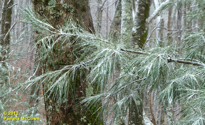
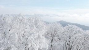
The month of December had been off to a warm start in Western North Carolina, with the average temperature in Asheville for the first 10 days of the month reported at 10.2° F above normal. However, Dec. 10’s nighttime cold front brought an end to the warmth. It is feeling like the holiday season has finally arrived — even bringing some light snow to the higher elevations in WNC. The image below shows a light dusting of fine snow on a white pine at 4,000 ft in Madison County on Tuesday morning, Dec. 11.
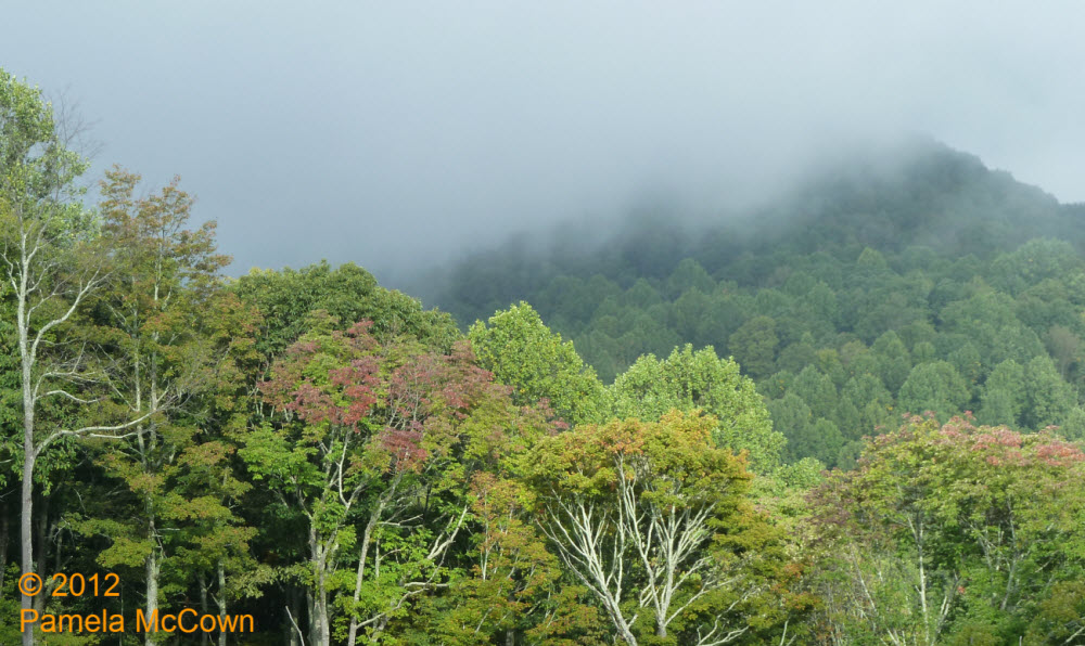
A totally different world exists just up the road
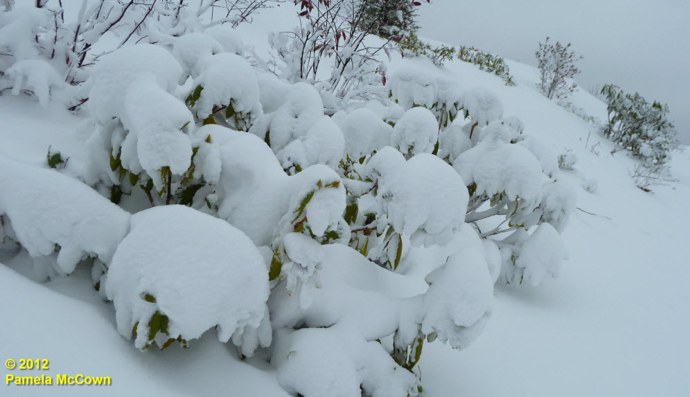
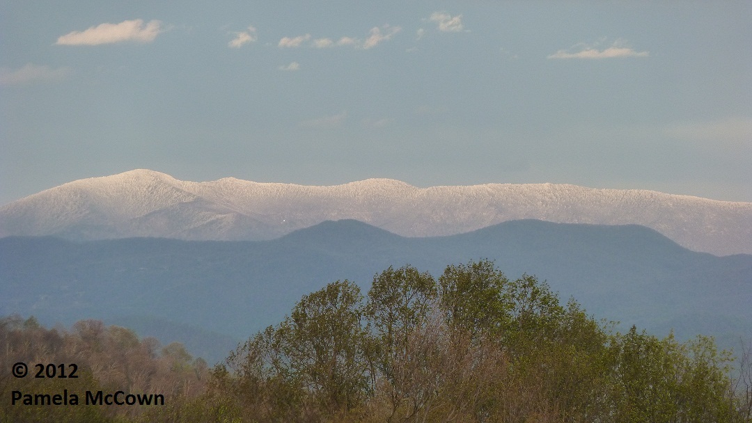
The snow that fell in Western North Carolina this week due to Hurricane Sandy was mainly isolated to the higher elevations, and unless you’ve been up in the mountains in the last couple of days, it’s hard to appreciate just how much snow the area received.
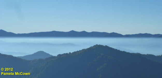
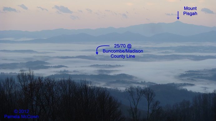
Inversion and balloons (much better than inverted balloons)
Fall brings many changes to Western North Carolina, from the turning of the leaves to the turning up of the thermostat. These cooler nights mean that many of us are heating our homes with wood-burning stoves and fireplaces to ward off the chill. Most of the time, the wood smoke (along with other particulates that are in the air) mix through much of the lowest layer of our atmosphere, called the troposphere. But when the air is cool and the winds are calm, we can occasionally see those tiny particles concentrated in the early morning air under what meteorologists call a radiational temperature inversion. Such was the case this morning, as you can see in the image below from Madison County, looking to the southeast across the valley toward the Craggies (image center) and the Blue Ridge Parkway.
Fog: Does that mean WNC will have snowy winter days?
Fog has been a common morning feature across the valleys in Western North Carolina for much of the summer and early fall. And while fog causes concern for travel because it reduces visibility, could it also be possible that the fog may be warning us of the coming winter?
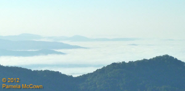
Lots of water
The beginning of this week started with significant rainfall over the region thanks to a large weather system that dumped a record amount of rainfall in Asheville on Tuesday, Sept. 18, and provided more rain in two days than we usually expect during the entire month of September! Our area’s rivers and streams are doing their job of transporting that water downstream — but the evidence of all that moisture was still hanging around early this morning in the form of low clouds. I shot the image below earlier today as the clouds were beginning to break at 4000 feet — revealing the early fall color that is starting to appear on ridgetops.
The first sign of coming change
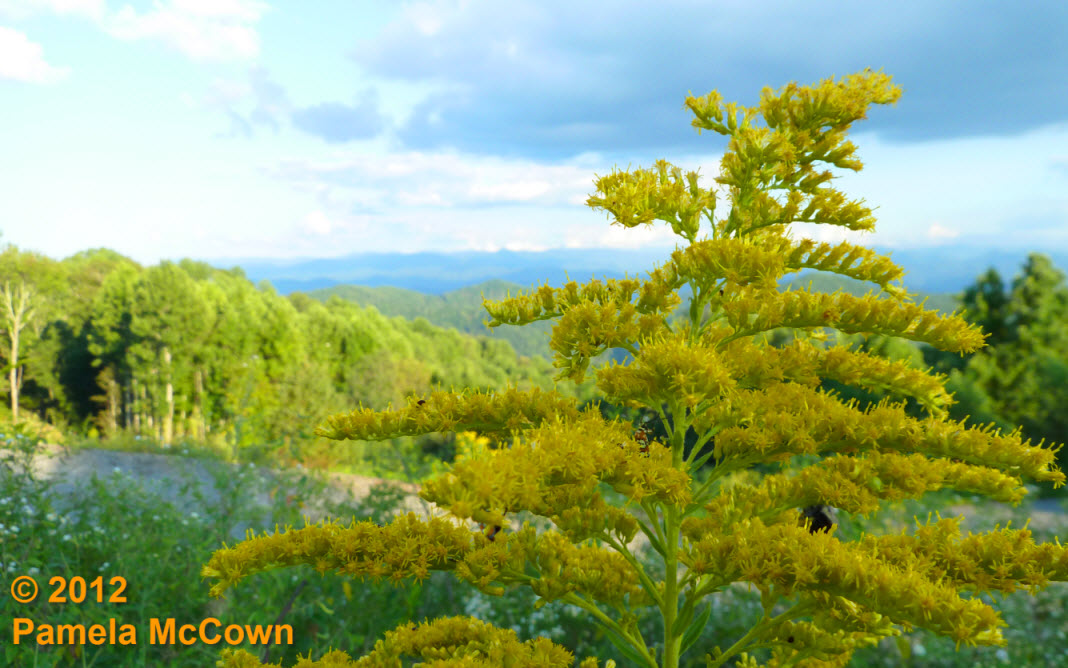
The bright yellows of Goldenrod are now plentiful in fields and along roadways in Western North Carolina; last weekend’s cold front brought cooler and drier air into the region; and you may have noticed that some of the leaves on the trees are beginning to lose their deep green color. These first signs of the coming autumn are a welcome sight to many of us who claim fall to be our favorite season.
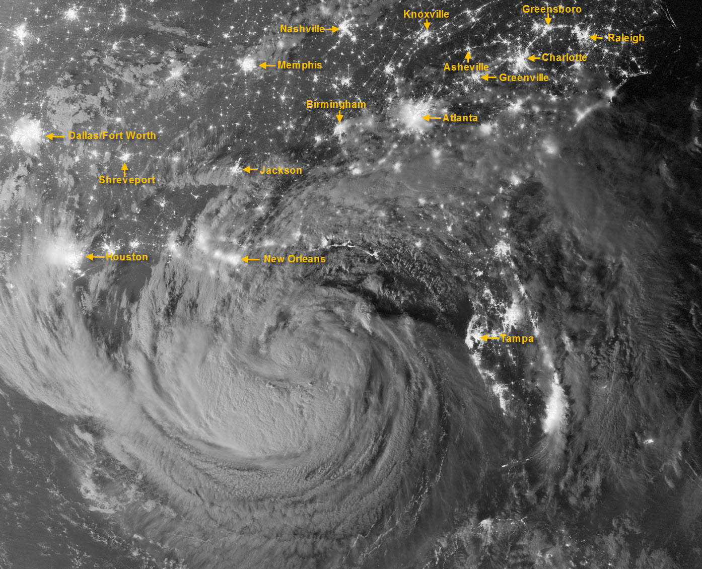
Isaac takes the coast by storm (at night!)
This amazing image of Tropical Storm Isaac was captured just after midnight on Tuesday, Aug. 28, by the Visible Infrared Imaging Radiometer Suite (VIIRS) on the Suomi-NPP satellite. Still off the Gulf Coast, Isaac’s clouds were lit by moonlight and the lights of cities across the Southeast U.S. are clearly visible. I’ve added labels for some of the more visible metropolitan areas, including Asheville.
Local Climatic Data Center scientist Anthony Arguez gets presidential honors
Asheville-based National Climatic Data Center climatologist Anthony Arguez is one of several winners of the 2011 Presidential Early Career Award for Scientists and Engineers.
The reason for the seasons
On June 20 at 7:09 p.m. EDT, we officially entered summer as people across the Northern Hemisphere noted the summer solstice. This event occurs at when the Earth’s northern axis is at its greatest tilt toward the Sun. It is because our planet is tilted on its axis of rotation by about 23.5 degrees that we experience seasons.
Solar pillar and contrails . . . Oh My!
Last week: Western North Carolina enjoyed some beautiful weather since the rain moved out on Wednesday, May 9. Those mostly clear skies set the stage for a beautiful sunset on Thursday, evening, May 10 — with some atmospheric optics to boot!

Late-April snow? It’s spring in WNC
While snow in April is not unheard of in Western North Carolina – this past weekend’s snow event seemed out of place, partly because
we had such a warm March this year.
The hockey stick and the climatologist: An evening with Michael Mann
Since publishing the Hockey Stick climate graph in 1998, climatologist Michael Mann has had his email hacked and picked apart for the purpose of incriminating and discrediting his studies; his family has received death threats. On April 3, he shared his story and conclusions during a presentation at Warren Wilson College.
Spring storms create a foggy morning
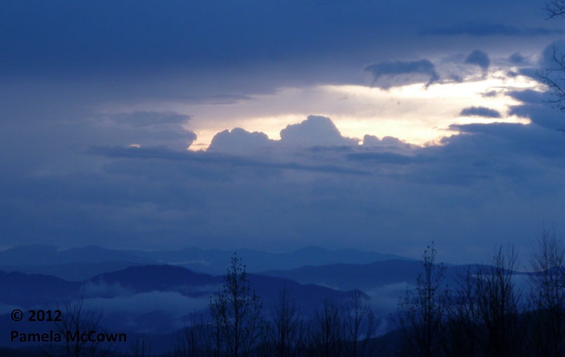
Spring brings the return of afternoon thunderstorms, but the impact of the rain can last long after the storms move on.
Spring has sprung!
As we woke up this week to the vernal equinox and the first full, official day of spring, many across Western North Carolina are dealing with an early spring that seems to have gone haywire.
The weather seesaw returns
Many of us woke up Thursday morning to widespread fog across the French Broad River Valley, thanks to rains overnight that caused the layer of air at ground-level to become saturated – producing a cloud on the ground – or fog. Big changes are on the way with a strong cold front bringing an end to the mild weather on Friday.
Where is winter? Look to the polar vortex
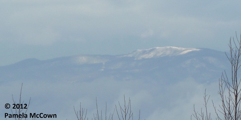
Snowflakes were flying earlier this week, as Valentine’s Day started off white at the higher elevations.
Snowflakes were flying earlier this week, as Valentine’s Day started off white at the higher elevations. This image of Max Patch in western Madison County shows the short-lived snow. So – what has happened to this winter? Why has it been so different than the last two years?
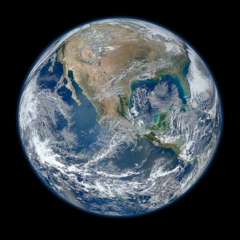
Our planet – A unique view of a truly unique place!
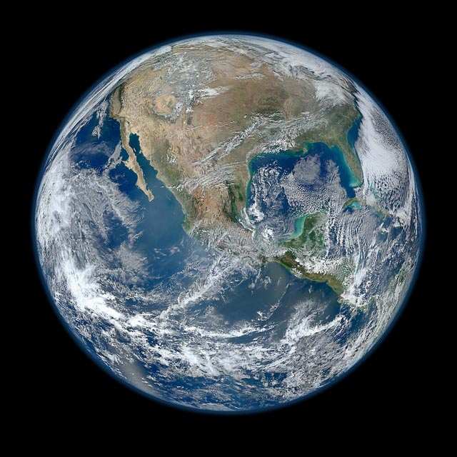
From the first full image of our planet shot by Apollo astronauts to the latest full disk image produced by NASA’s Suomi NPP satellite — we continue to marvel at the beauty of our unique planet as we gather critical data about its weather and climate.
NOAA meteorologist offers seasonal forecast for WNC winter
A winter weather advisory has been issued for the Western North Carolina mountains today, Dec. 7, beginning at 4 p.m. Last night, NOAA meteorologist Tom Ross presented a look at the long-range winter forecast for WNC: Ashevillians may enjoy (or complain about) plenty of snow again this winter.
Asheville-based National Climate Data Center turns 60
_thumb.jpg) Weather Channel junkies, you are not alone. People have been obsessed with weather — and recording weather observations — for quite some time. Retro outfits and mod hairdos are no longer on view, but the Asheville-based National Climate Data Center celebrated its 60th birthday last week, and the center wants folks to know about the fascinating weather and climate information it has collected over the years.
Weather Channel junkies, you are not alone. People have been obsessed with weather — and recording weather observations — for quite some time. Retro outfits and mod hairdos are no longer on view, but the Asheville-based National Climate Data Center celebrated its 60th birthday last week, and the center wants folks to know about the fascinating weather and climate information it has collected over the years.