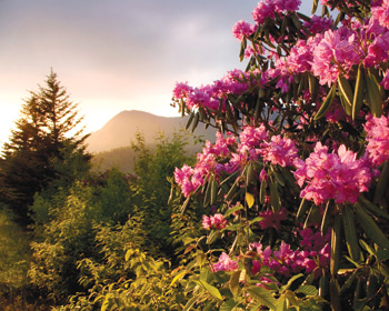
June means blooming rhododendrons, and one of the best places to see them has reopened after a yearlong wait: the Blue Ridge Parkway from Bull Gap (milepost 355) to Mount Mitchell State Park (milepost 375).
I first visited this area 10 years ago, but in March 2008, the beloved section was closed after the steep slope across from the visitor center began to crumble and slide. Rangers deemed it unstable in the wake of winter storms, barring even cyclists and hikers from proceeding through. As far back as Bull Gap, trees and other debris had to be cleaned up, and even weeks after the May 15 reopening, roadwork and retaining-wall construction are ongoing.

So be cautious when you tour the route. Between mileposts 359 and 375, the road narrows to a single lane. Flagmen and traffic lights control the flow through this tight stretch, and the rough pavement means you need to be especially mindful of motorcycles and bicyclists. Additionally, crews are using large excavators and front loaders below the road, tempting drivers to peer over. To make things even more exciting, fog is a common challenge throughout this section.
Riding a motorcycle or bicycle in the fog on a twisty road can make you feel like a target or a soon-to-be speed hump. It’s especially scary when you’re going through the tunnels: Drivers often hit their brakes at the tunnel entrance, abruptly dropping down to 10 miles an hour or less, which is doubly treacherous when visibility is limited. And despite the many dedicated overlooks, visitors often pull over for photo opportunities directly after tunnels and just around corners that open onto sweeping views.
But as workers re-pave the Parkway, many overlooks north of Craggy Gardens will be closed at times, making it impossible to turn around just north of the tunnel at the visitor center. Still, motorcyclists can once again ride from Asheville to Highway 80 north of Mount Mitchell, travel along beautiful twisty roads, and descend east to Marion or west to Micaville. For a shorter road trip, however, turn around at the visitor center—or linger to appreciate all the hikes and picnic areas available there.
You’ll be rewarded. By early June, the heath balds along the Parkway are typically drenched in pink as far as you can see. Folks can take a short, fairly flat hike through the hobbitlike undergrowth, emerging into open fields of flame azalea and pink rhododendron. The hidden, grassy coves are perfect for naps, picnics, yoga or meditation as bees create a monotonous hum, floating between veritable feasts of pollen and too busy to notice humans. Beware of men sunbathing in tiny swimsuits, however—a sight I once stumbled on.
Meanwhile, local and visiting cyclists can once more tackle the grueling climb from Asheville (elevation about 2,200 feet) to Mount Mitchell (elevation 6,684 feet). The ride up Town Mountain Road is tough, but it only gets worse as you pump your way up those last 20 miles to the peak. A guy I know got so exhausted and hungry during his first attempt, he stopped to snarf down a package of donuts he spotted in a ditch, flung from a car like an offering from the goddess.
If you’re looking for a little less suffering, a great day hike is the trail to Douglas Falls, which plummets some 60 feet from a rocky ledge. Hiking about six miles down from the Parkway at Craggy Gardens is a lot more challenging than approaching the falls from the Coleman Boundary (aka the Big Ivy section of the Pisgah National Forest)—accessible by driving through Barnardsville on Highway 197, turning up Douglasville Road, then continuing up the graveled Forest Road 74 till you reach the parking lot, about a mile from the falls. But either way, it’s quite lovely and fun.
My first time visiting there was more than 10 years ago, when I lived in Durham. I had no idea how heavily visited the falls were. My girlfriend and I thought we were in the middle of nowhere, and we showered naked in the breathtakingly chilly waters. I think of that every time I see a church bus parked at the top of FR 74, from whence it’s distressingly easy and quick for just about anyone to reach the falls.
For general information, visit www.blueridgeparkway.org. For information about road conditions, visit www.nps.gov/blri/planyourvisit/roadclosures.htm or call 298-0398.
[Bettina Freese lives and bikes in Asheville.]


we tried to find douglasville road yesterday in hopes of doing the short hike to douglas falls.
we followed your directions coming in from 1-26,
never found douglasville road and ended up in pensacola & burnsville. should we have taken a right on dillingham road in barnardsville?
thanks
paul chapman
morganton