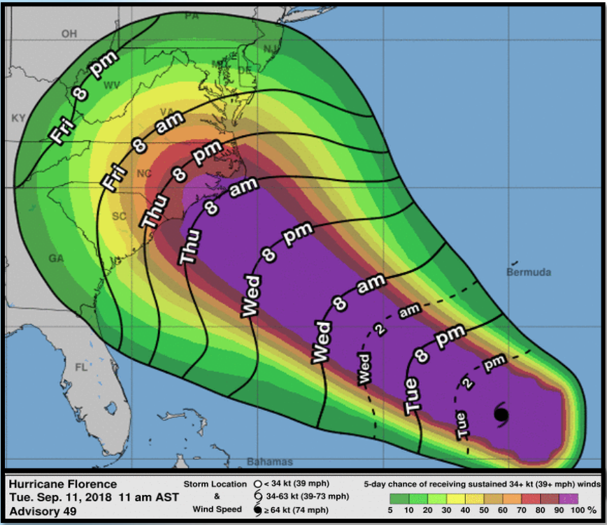
Summary of National Weather Service briefing:
The National Oceanic and Atmospheric Administration’s National Weather Service is providing regional-specific briefings on the expected impacts of Hurricane Florence. The latest briefing, issued on Sept. 11 at 12:40 p.m., urges all residents of the region to complete their hurricane preparations by the evening of Wednesday, Sept. 12.
The NWS expects Florence to make landfall as a major hurricane sometime late Thursday night or early Friday morning. Tropical storm-force winds could arrive as early as Wednesday night. The hurricane’s current maximum wind speed is 130 miles per hour.
Life-threatening impacts are likely due to wind, storm surges and flooding rain. Most low-lying areas of Eastern North Carolina are at risk, with up to 12 feet of flooding above ground level possible along the Neuse and Pamlico Rivers. Over 20 inches of rain are possible in certain areas.
Gov. Roy Cooper has declared a state of emergency ahead of the Florence’s arrival. He advised that North Carolinians should not attempt to ride out the storm.
For more information on North Carolina’s response, visit the N.C. Department of Public Safety website. Follow NWS updates on the storm here.


Before you comment
The comments section is here to provide a platform for civil dialogue on the issues we face together as a local community. Xpress is committed to offering this platform for all voices, but when the tone of the discussion gets nasty or strays off topic, we believe many people choose not to participate. Xpress editors are determined to moderate comments to ensure a constructive interchange is maintained. All comments judged not to be in keeping with the spirit of civil discourse will be removed and repeat violators will be banned. See here for our terms of service. Thank you for being part of this effort to promote respectful discussion.