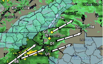
The National Weather Service has issued a Winter Weather Advisory for WNC from 5 a.m. Monday through 10 a.m. Tuesday, Feb. 3: “The combination of falling snow, strong gusty winds and widespread black ice will make travel dangerous Monday through mid morning Tuesday,” the NWS warns. High winds could result in fallen trees. Here’s the full advisory:
..Winter Weather Advisory in effect from 5 am Monday to 10 am EST Tuesday…
The National Weather Service in Greenville-Spartanburg has issued a Winter Weather Advisory for snow and widespread black ice…which is in effect from 5 am Monday to 10 am EST Tuesday.
* Locations…Tennessee border counties of North Carolina…portions of the southern North Carolina mountains…and mountains of extreme northeast Georgia.
* Hazards…snow…strong gusty winds…and widespread black ice.
* Timing…strong and cold northwest winds will develop across the region Monday morning. The gusty northwest winds will support numerous snow showers from early Monday morning into the late afternoon. Winds are expected to strengthen across the mountains on Monday…with gusts peaking during the early afternoon. In addition…falling daytime temperatures will likely create widespread black ice across the region on Monday…remaining until Tuesday morning.
* Accumulations…snow accumulation of one to two inches. Amounts may approach three inches across favored upslope areas near the Tennessee line.
* Impacts…the combination of falling snow…strong gusty winds…and widespread black ice will make travel dangerous Monday through mid morning Tuesday. In addition…winds will strengthen across the area on Monday…possibly resulting in falling trees and limbs.
* Temperatures…in the upper 20s sunrise Monday. The rest of the day…temperatures steady within the valleys falling across the ridges. Monday night…temperatures falling into the mid to lower teens…rising steady after sunrise Tuesday.
* Winds…northwest 20 to 30 mph with gusts up to 55 mph on Monday.
Precautionary/preparedness actions…
A Winter Weather Advisory for snow means that periods of snow will cause primarily travel difficulties. Be prepared for snow covered roads and limited visibilities…and use caution while driving.
A Winter Weather Advisory for black ice means that refreezing of roads will occur…resulting in the development of widespread black ice. Be prepared for very slippery roadways. Some roads that appear clear may be covered by a thin layer of ice.
Please report snow and ice accumulations by calling the National Weather Service toll free at…1…800…2 6 7…8 1 0 1. Leave a message with your observation and the specific location where it occurred. You can also Post your report to National Weather Service Greenville Spartanburg facebook or tweet your report using hashtag nwsgsp.
Stay tuned to NOAA Weather Radio or your favorite source of weather information for the latest updates. Additional details can be found at www.Weather.Gov/gsp.


Before you comment
The comments section is here to provide a platform for civil dialogue on the issues we face together as a local community. Xpress is committed to offering this platform for all voices, but when the tone of the discussion gets nasty or strays off topic, we believe many people choose not to participate. Xpress editors are determined to moderate comments to ensure a constructive interchange is maintained. All comments judged not to be in keeping with the spirit of civil discourse will be removed and repeat violators will be banned. See here for our terms of service. Thank you for being part of this effort to promote respectful discussion.