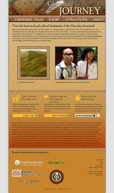
An interactive website is making it possible to take a virtual hike across the historic Cherokee Indian trails and villages of Western North Carolina.
Called Cherokee Journey, the site overlays old trails onto modern roadmaps, using Google Earth technology to let users explore 18th century Appalachia in 3-D.
“There are thousands of scattered archives delineating the history of the Cherokees that simply are not available to the average person,” says Lamar Marshall, cultural heritage director at Wild South, the Asheville-based nonprofit that spearheaded developing the site. He spent nearly four years researching hundreds of historical maps, documents and records that provided the foundation for Cherokee Journey.
Last fall, after contacting local Web design firm TopFloorStudio, the group landed a $20,000 Google Earth Outreach grant to develop the idea. Working with members of the Eastern Band of Cherokee Indians, Marshall helped create an online resource filled with geographic and cultural material about the Cherokee people.
And TopFloorStudio head Ty Hallock integrated interactive Google Earth maps and virtual tours into a Web platform and a smart-phone application for Android phones. Noting his personal interest in the project, Hallock says, “I grew up in Cherokee, right off the reservation, so the content was very interesting. And I’m really a technology advocate and huge geek.”
Hallock says the website and its Google Earth components took about four months to complete before Wild South could add the content. The geolocation aspect allows users to dive right in and learn information about the surroundings here, he explains.
“You can really experience the history of Cherokee through Google Earth,” Hallock says. “It will do a fly-through in Cherokee and show you the history as things progressed, and show you where the villages were and where tribes migrated from.”
Hallock commends Marshall for shepherding the project, even picking a basic look for the website that conveys that “adventurous feeling.”
Says Marshall: “Our vision is that this project will graphically illustrate cultural geography by embedding it into the landscape through colorful, interactive, 3-D interfaces.”
In addition to virtual tours, the site will feature historic maps, geographic lessons, information about Cherokee trails and local attractions such as the Oconaluftee Indian Village. Lessons walk readers through the landscape and ecology of 18th century Cherokee territory, trade patterns and tribal conflicts. The site aims at promoting tourism in the area by getting people interested in its history.
Keen on presenting information accurately as well as sensitively, Marshall notes that no archaeological or sacred materials will be put online.
Ben Prater, associate executive director of Wild South, has high hopes for the continuing development of the site. “Wild South is dedicated to preserving the natural legacy of Western North Carolina and beyond. The history and culture of the Cherokee people are a part of this region’s natural landscape, and educating others through this collaborative project will inspire them to respect and appreciate the region’s historical and natural heritage.”
To visit the website and download the Android phone application, go to cherokee.wildsouth.org.
— Information provided by Wild South.


Before you comment
The comments section is here to provide a platform for civil dialogue on the issues we face together as a local community. Xpress is committed to offering this platform for all voices, but when the tone of the discussion gets nasty or strays off topic, we believe many people choose not to participate. Xpress editors are determined to moderate comments to ensure a constructive interchange is maintained. All comments judged not to be in keeping with the spirit of civil discourse will be removed and repeat violators will be banned. See here for our terms of service. Thank you for being part of this effort to promote respectful discussion.