


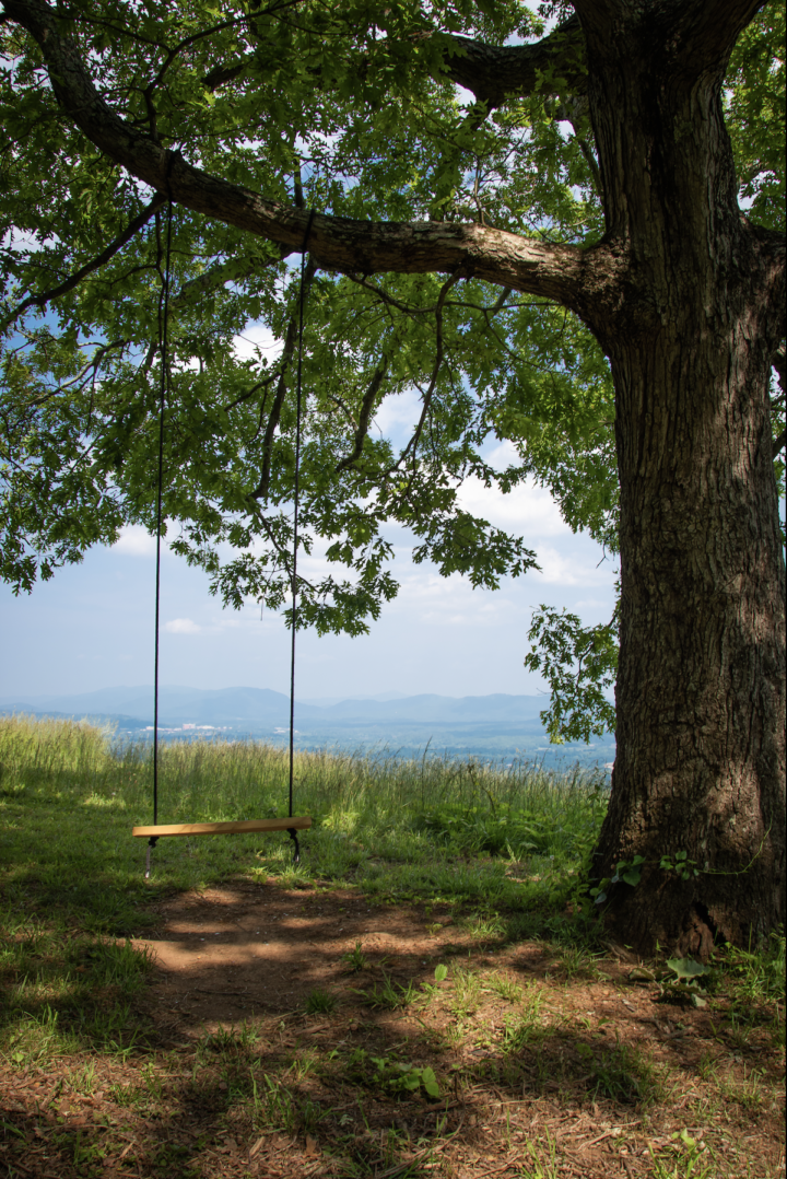
When you emerge from underneath the oaks on Deaverview Mountain’s highest point, a jaw-dropping panorama of the French Broad Valley materializes. With contiguous sightlines from Weaverville to Bearwallow Mountain and Bent Creek, there might not be a better view of Asheville below the clouds — and soon it may be accessible to anyone with as little as a bus pass.
The 342-acre tract atop Deaverview Mountain was purchased by an anonymous conservationist in March with the intention of selling the land to the Southern Appalachian Highlands Conservancy. SAHC has three years to obtain federal and state grants to repay the buyer, then it plans to turn the property over to Buncombe County as a park or preserve.
The land has been in private hands for decades, most recently owned by John Ward and Pamela Whitney before they sold it to Deaverview Mountain LLC in March for $7.3 million.
Ward and Whitney had various plans for developing the mountaintop property, including building a multi-unit high-end development before ultimately deciding to sell the entire tract with the understanding it would be conserved, according to Jay Leutze, senior adviser to the SAHC board.
“I love that it connects us all, people who have been here a long time and those that have moved here more recently,” says Buncombe County Commissioner Terri Wells.
Just 5 miles from downtown, the entrance road to Deaverview is about a half-mile from the closest bus stop on Deaverview Road.
“One of the reasons I got so excited about it is because of that proximity to a large part of our population that will then have access to this wonderful mountain park with these trails,” Wells says.
‘A dream come true’
Neighbors and conservationists are also thrilled about the potential to prevent the development of what those familiar call one of the most “iconic” vistas in Buncombe County and to provide public access to a natural area in a part of the county with few existing parks.
“We don’t have a lot of outdoor recreation access of that quality right in town,” says neighbor Jamie Ervin, an outdoor recreation policy advocate for Outdoor Alliance. “And so, a benefit is that it creates more of an opportunity to help people who maybe don’t have a background in outdoor recreation or people that have been historically excluded from outdoor spaces or don’t feel welcome there. They have much less of a barrier to getting outside and seeing a really good view and just building a better connection with the mountains in our area.”
Josh Kelly, a public lands biologist for MountainTrue who’s hiked in the area numerous times with permission from previous owners, adds that the site would be Buncombe’s first county-owned forest park. “And that location is pretty neat because it kind of straddles the divide between Asheville, Leicester and Erwin Hills, and has an Appalachian-urban feel to it,” he says.
Furthermore, several prominent streams in West Asheville like Smith Mill, Ragsdale and Canie creeks start on Deaverview’s slopes, and Kelly says the presence of salamanders indicates high water quality in those headwater springs.
Deaverview is also where Kelly first learned to identify birds by ear because of its convenient location and diverse bird habitat, including a mature oak forest, he says.
Meanwhile, longtime Erwin resident Kim Plemmons, a Buncombe County Board of Education member, is especially excited about the opportunities a mountain park might afford students from nearby schools.
“Having a park there is just, it’s almost like a dream come true for this community because we need these types of things and these types of venues for kids and teenagers [to enjoy],” Plemmons says.
Plemmons says Angie Trantham, principal of Johnston Elementary, located 1.5 miles from the mountain’s access road, already has plans for field trips up the mountain. The opportunities for on-site instruction and connection with nature for all schools, but especially those in the Erwin district, are endless, she says.
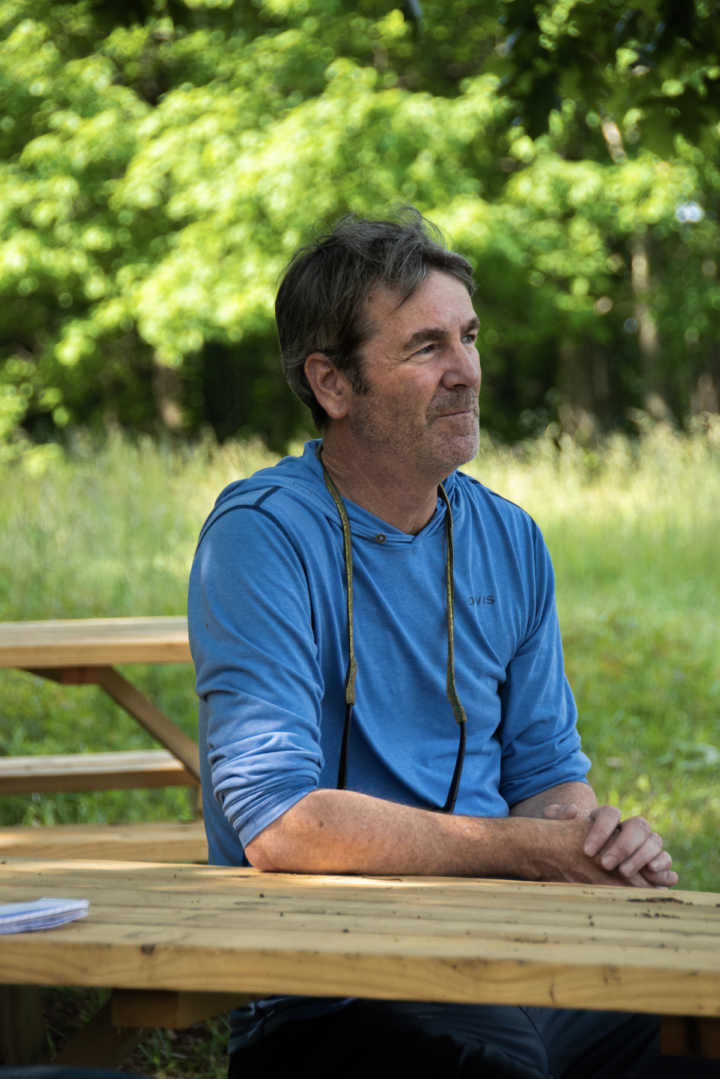
Leutze echoes that sentiment.
“Every kid that comes up here will be moved the way I’m moved when I’m here. And that leads to curiosity and a desire for more exploration. And I think this can be the kick-start for lots of kids getting their first nature fix. And once you’ve had this feeling, you want it again,” Leutze says.
“And those become our ambassadors for more parks on the valley floor, more connectivity for wildlife and addressing invasive species in our landscape. Those are such important things facing us right now.”
Deaver’s view
Deaverview has a rich cultural history dating back to early Asheville.
In the 1800s, the mountain was referred to as Mount Yeadon, named after the editor of the Charleston Courier, and was noted for its views of Asheville and the Hominy Valley, according to several books written about the time.
Eventually, the mountain fell into the hands of its namesake, Reuben Deaver, who operated the nearby Sulphur Springs Hotel with his father-in-law, Robert Henry. The original hotel was built in 1834 and became one of Asheville’s first tourist attractions.
There are multiple accounts of visitors and residents traveling up to a vista near the hotel for its views, including one from Mountain Scenery by Henry E. Colton, published in 1859.
“The view of the valley of Hommony [sic] Creek is extremely good, and enables one to form at a glance a correct idea of the supassing [sic] fertility of that region. It is about two and a half miles from the Springs to the top of this little mountain. The traveller [sic] who visits Asheville will most certainly go to the Sulphur Springs; and, when there, a jaunt to Mount Yeadon is indispensable to the full appreciation to the [sic] attractions of that section.”
A fire destroyed the hotel in 1861. Decades later, the property was rebuilt and renamed before it too was consumed by flames in 1892.
Hooch on ‘Bald Spot’
A century later, the family of longtime local resident David Warren was still recreating on the mountain and the adjacent Spivey Mountain, even using its springs to distill moonshine in old clawfoot bathtubs, he says.
Warren says his grandfather was one of the best liquor makers around, even attracting a congressman up to the woods to try his hooch.
Neighbors could tell when Warren’s grandfather had a fresh batch because the creek coming off the mountain would turn white from him washing out his equipment up the slope, he says.
When Warren was growing up, Deaverview was referred to as Bald Spot, after its treeless southern vista, a spot made possible by previous owners running as much as 100 head of cattle on the mountain. Since then, the forest has grown considerably toward the opening, limiting what are still expansive views to the south and east.
It was common for teenagers to take their dirt bikes up the mountain in the 1970s and ’80s, Warren says, some with permission and some without.
Other local tales
Like Warren, others within the community have similar memories of the site’s former use. Aside from dirt biking, Plemmons says teenagers also used the mountain as a date spot. She adds that before she married her husband, he would take her as close to the top as he could get in his Jeep.
Many neighbors say they accessed Deaverview, or “Old Baldy,” via trails originating off Spivey Mountain Road, and therefore some incorrectly still refer to the entire area as Spivey Mountain. According to U.S. Geological Survey maps, Spivey’s peak lies to the north on a different private tract that includes communication towers. That tract is closed to the public and has been for years.
At one point, when neighbors could hike Deaverview via Spivey Mountain Road, local musician Kendra Warren, David Warren’s daughter, wrote a song, “Spivey Mountain Jam,” about a story her dad tells from his childhood on the mountain.
According to the song, Kendra Warren’s dad stole cigarettes from his father and started a fire somewhere in those woods.
Ben Gilmer, who has lived in the Deaverview area for years, brought his kids up to the vista regularly before owners cracked down on unapproved access via Spivey Mountain Road several years ago.
“It just means a whole lot to [the kids]. They’ve seen pictures of themselves up on the mountain when they were younger. It felt like a real loss to have this sort of beautiful mountain playground taken away from them. And so, they’re very excited about having the chance to get back there,” Gilmer says.
The key to Asheville’s future
Now, if SAHC is successful in securing funds, Deaverview will be publicly managed and open to all.
“It’s like a really good view. I mean, it’s on par with places you would go hiking off the parkway, and it’s really cool to see downtown Asheville, just like it’s the kind of place that will help people love the outdoors,” says Ervin.
“That’s how we create people that are going to care for the mountains and are going to protect our region over the long term by exposing them to places like that.”
Leutze, who wrote a book about his work conserving Roan Mountain, says he sees conserving Deaverview as possibly the key to Asheville’s future for many reasons.
“You can see for miles,” Leutze says. “That means also you can see threats, and you can see what a changing climate is going to do on the landscape scale. So, I think of this as a critical window, a really amazing laboratory and window into the landscape.
“And conservationists have all come to the conclusion that our work needs to not be discrete pockets,” he continues. “It needs to be landscape wide, in order to have real impact and help a landscape respond to a changing climate and a growing population. If we don’t lock down these greenways and trails and forest linkages now it only gets more expensive in the future.”
Before you comment
The comments section is here to provide a platform for civil dialogue on the issues we face together as a local community. Xpress is committed to offering this platform for all voices, but when the tone of the discussion gets nasty or strays off topic, we believe many people choose not to participate. Xpress editors are determined to moderate comments to ensure a constructive interchange is maintained. All comments judged not to be in keeping with the spirit of civil discourse will be removed and repeat violators will be banned. See here for our terms of service. Thank you for being part of this effort to promote respectful discussion.