

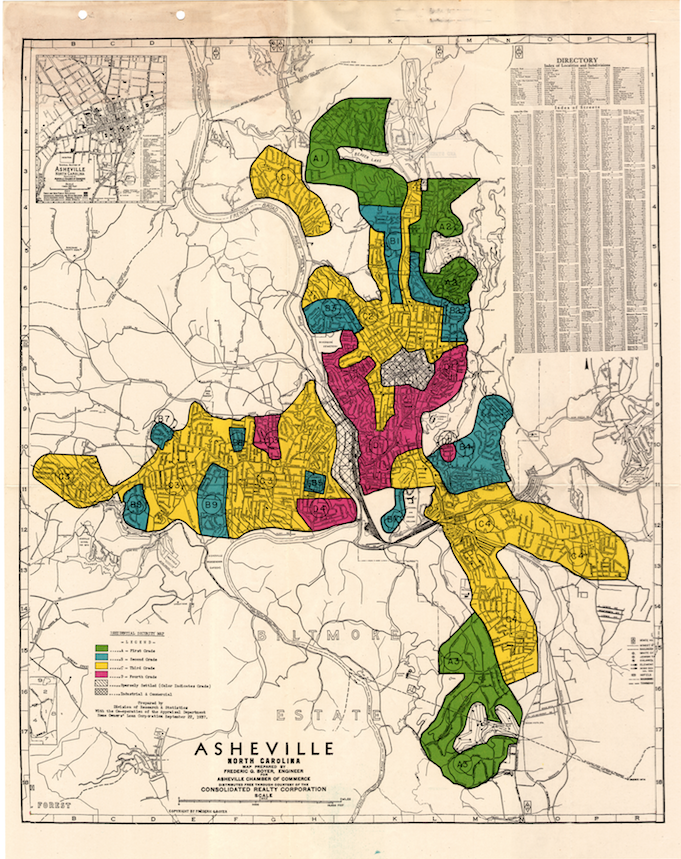
RED ZONE: In 1933, the Home Owners Loan Corp. began creating created color-coded maps of metropolitan areas throughout the country. Asheville’s map, completed in 1937, designated a large part of the city in red. Field notes from the effort indicate that all of the “hazardous” areas — including the East End and South Side neighborhoods — were majority black.