Asheville and the surrounding areas continue to see above normal rainfall during this wet spring. Now, add Tropical Storm Andrea into the mix – and you get atmospheric soup (pass the crackers!)
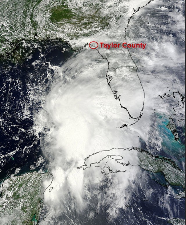
Image credit: NASA’s Terra satellite (with annotation by Pamela McC
Author: Pamela McCown
Showing 1-21 of 50 results
In Full Bloom
Our wet spring has helped to bring an amazing display of color across the region as the Rhododendron are in bloom across many of the higher elevations. If you’re socked in, listening to the Sunday rain, keep in mind that colorful flowers may soon follow.

The lowdown on the low that’s got us down
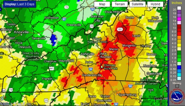
Extensive rains across the region over the weekend caused numerous problems with flooded rivers, creeks, roads, downed trees and landslides. And we can look to a pesky area of low pressure that’s hanging out in our area as the instigator of all this trouble.
If April showers bring May flowers, we should be set
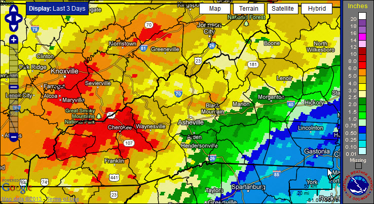
After a wet April, it looks like the large-scale weather pattern will not shift much as we head into this first week of May. And, while Asheville received above normal rainfall for the month of April, some locations west of the French Broad River Valley were soaked with over 14 inches of rain.
Blossoms, buds and a frost warning?
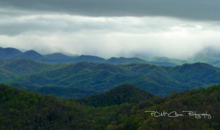
It seems like it took forever to get spring going this year. The wet and cool conditions we’ve experienced during the late winter and early spring in Western North Carolina made it feel like winter just refused to leave our region. (But — even now — there’s a possibility of frost Thursday night, April 25.) They say that good things come to those who wait, and it must be true, because many locations are enjoying gorgeous blooming trees.

Anticipation: waiting on the trees and the storms
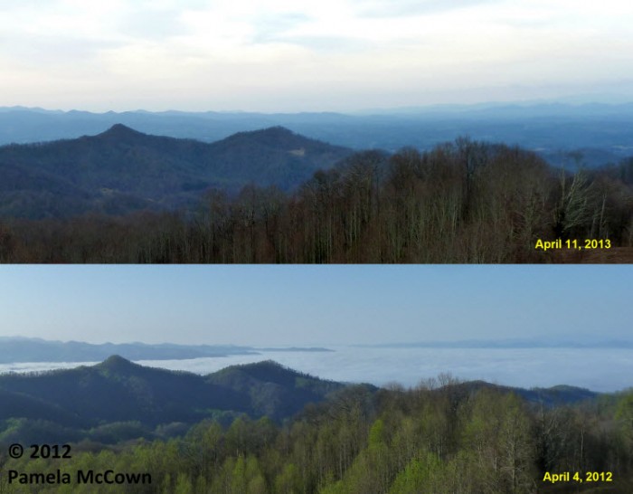
It’s amazing how different each year can be as the ever-changing seasons unfold before our eyes. You may remember that the spring of 2012 was warm — very warm, with average temperatures last March that were over 9 degrees above normal in Western North Carolina. This year has been significantly different.
Warming up: finally
No doubt about it, late winter and early spring in Western North Carolina have been cooler and wetter than we normally expect. But it looks like the coming weekend should bring some much needed sunshine and a return to near normal temperatures. Just remember: The risk for frost and freeze is not over just yet.
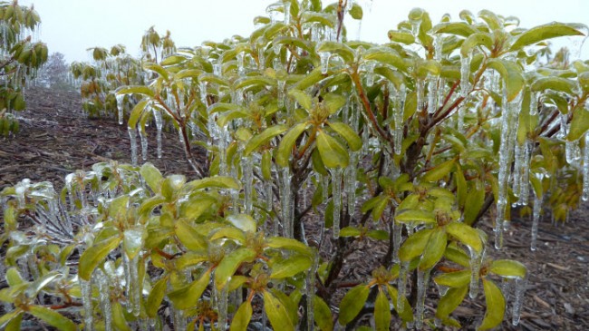
The snow hangover
Significant snow fell again over the higher elevations earlier this week (just before Easter), which, honestly, produced too much of a good thing for many folks in the region. I could use some “hair of the dog,” or in this case, some “green of spring” to get me over this snow hangover.
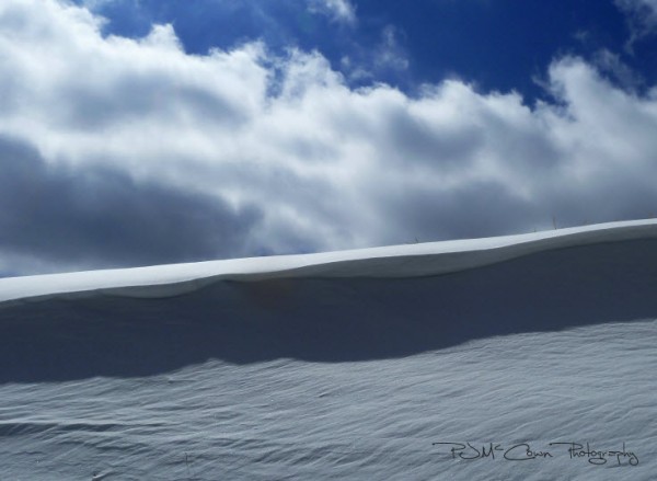
Happy spring? Yeah, right!
A small, fast-moving and dynamic system brought snowfall to many places in the region Wednesday night, March 20. And, of course, it happened on the first day of spring!
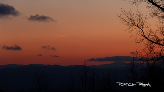
Comet watch and coats
No doubt about it: March is off to a chilly start so far. Today’s sunny skies are almost enough to fool you into thinking that spring has arrived … until you step foot outside and the brisk breeze and cold air reminds you that it’s still late winter. If the clouds cooperate, I encourage you to bundle up and take the opportunity to spot the comet PanSTARRS low on the western horizon after sunset for the next week.
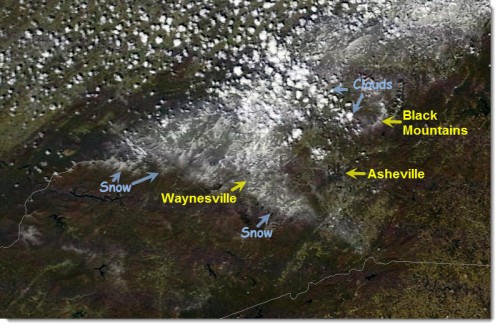
A real snow job
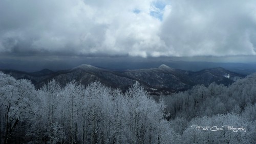
Were you part of the “haves” or the “have not-so-muchers” this week? Those who live in the higher elevations received a big dose of snow while the Asheville Regional Airport saw just a trace.
The snow moon: Will it be right?
Did you know that each full moon has a name? Most of us have heard of the Harvest Moon, the full moon that occurs in October. In North America, the full moon in February is known as the Snow Moon (or the Storm Moon). February’s full moon occurred on Monday of this week, and it made a beautiful entrance over the eastern horizon.

Stunning sunset: Another day in Western North Carolina’s winter weather
Timing is everything, especially when weather conditions change as quickly as they do in the mountains. Tuesday morning, Feb. 19, brought huge fluffy snowflakes to the higher elevations, quickly adding up to a couple of inches of snow. The whiplash of a day ended with a stunning sunset that was enhanced by concentric halos around the setting sun. 
Impressive clouds and some cool news
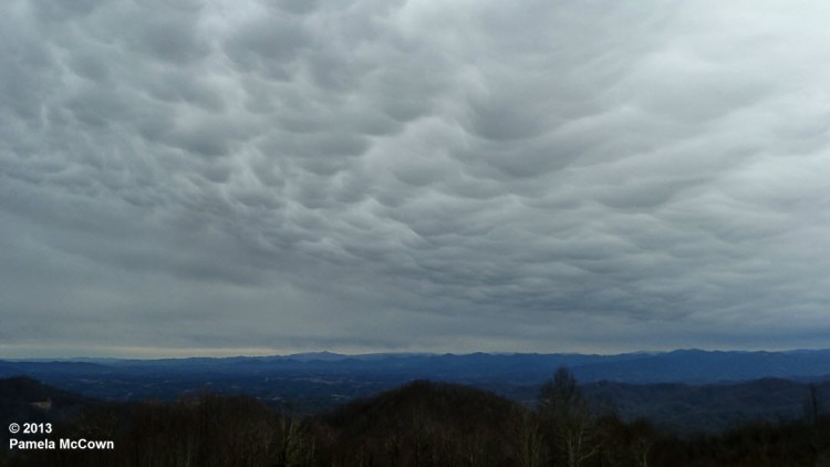
It’s fair to say that Western North Carolina has been in an active weather pattern this winter. Every few days, another system approaches the region from the west or northwest, bringing changing weather conditions. And this week was no different. Tuesday afternoon saw another one of these systems roll in and as it did, it also brought some amazing clouds that swept over the valley.
Where did the snow fall?
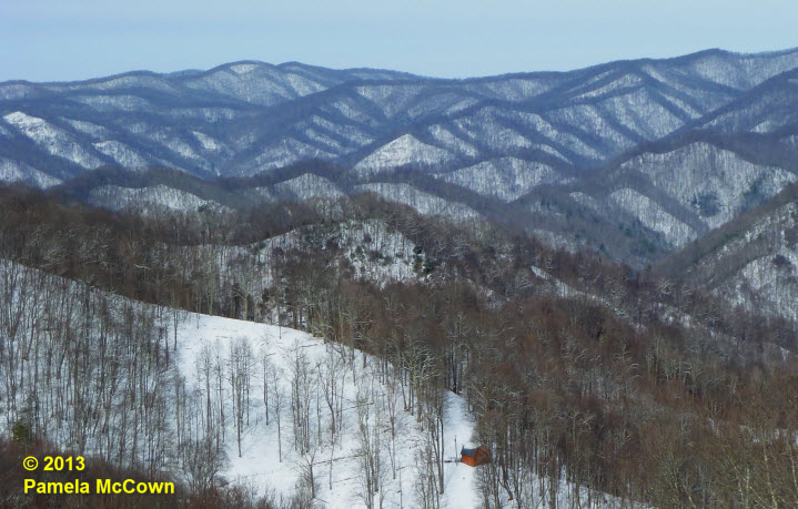
Western North Carolina can seem like a land divided at times. The complex terrain of this region has a significant impact on the climate and the type of weather that we experience at any given location. The higher elevations experienced significant snow though out the multi-day event, while many folks in the valley were left with just a few flurries.
Ice, then fire. Be prepared for the clash of the Titans (and a High Wind Warning)
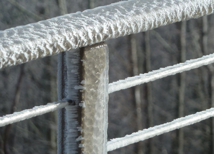
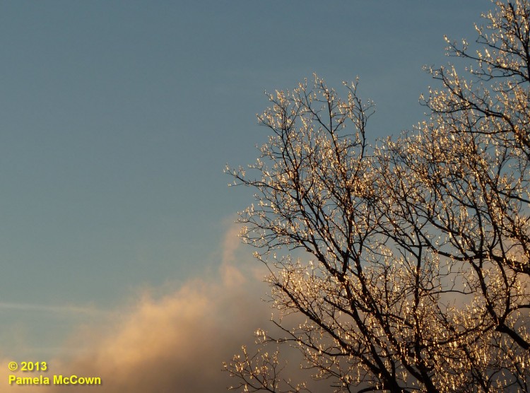
Last week’s ice-and-sleet storm left a mess in several counties across Western North Carolina. The complex temperature structure in the atmosphere resulted in a thick coating of ice in some areas, but produced just rain in others. Now, after several days of spring-like temperatures, spring-like thunderstorms will impact the region on Wednesday, Jan. 30. A High Wind Warning has been issued by the NWS.
The challenges of winter weather
Winter can bring all kinds of challenges to the mountains — from cold and windy conditions like we’ve seen today to the threat for wintry weather. And, while snow can bring an almost festive vibe to our area, the threat of freezing rain or sleet is a whole other story.
Winter is about to arrive
After three days of rain, many locations in Western North Carolina have reported significant rainfall. Now, the larger-scale weather pattern appears to be shifting into a more winter-like pattern for the Eastern U.S., with a significant winter storm expected later today and arctic air moving in over the weekend. So, hold on: It looks like it’s going to be a bumpy ride!
What will 2013 bring?
Weather conditions in our region so far this year have been described as “mild” — with average temperatures at Asheville Regional Airport running slightly above normal for all but three days since the start of the New Year. And, while it’s hard to find too many folks who complain about mild temperatures in January, it does force the question: How will the weather of 2013 compare to that of 2012?
December makes its big entrance
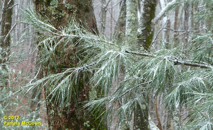
The month of December had been off to a warm start in Western North Carolina, with the average temperature in Asheville for the first 10 days of the month reported at 10.2° F above normal. However, Dec. 10’s nighttime cold front brought an end to the warmth. It is feeling like the holiday season has finally arrived — even bringing some light snow to the higher elevations in WNC. The image below shows a light dusting of fine snow on a white pine at 4,000 ft in Madison County on Tuesday morning, Dec. 11.
Round 2 for the Northeast U.S.: The difference between a hurricane and a nor’easter
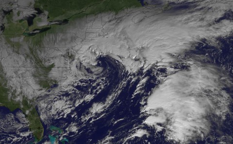
While millions in the Northeast are still trying to recover from the impacts of Hurricane Sandy, the region is bracing for the impact of yet another storm — the infamous nor’easter. (Tonight:Meteorologist Tom Ross will present the long range winter weather outlook. — 6 p.m. at Ferguson Auditorium at A-B Tech.)


