

Last week’s ice-and-sleet storm left a mess in several counties across Western North Carolina. The complex temperature structure in the atmosphere resulted in a thick coating of ice in some areas, but produced just rain in others. The event was a true testament to the complexity of our region and the varied weather that we can experience across relatively short distances.
The image below shows the coating of ice that I found on the railings around my home. The metal railing and the cables (along with EVERYTHING else) were covered in ice that resulted from the 1/4- to 1/3-inch of freezing rain that we received on Friday, Jan. 25. Meteorologists call ice like this — which forms as the result of freezing rain — clear ice.
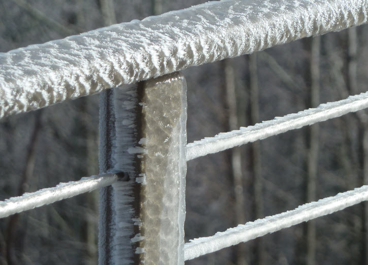
But ice comes in different varieties depending on how it forms. If you look closely at the image above, you will notice that in addition to the clear ice that coats the railing, there is also a more feathery type of ice. This is called rime ice, and it is a frequent visitor to the higher elevations of our mountains.
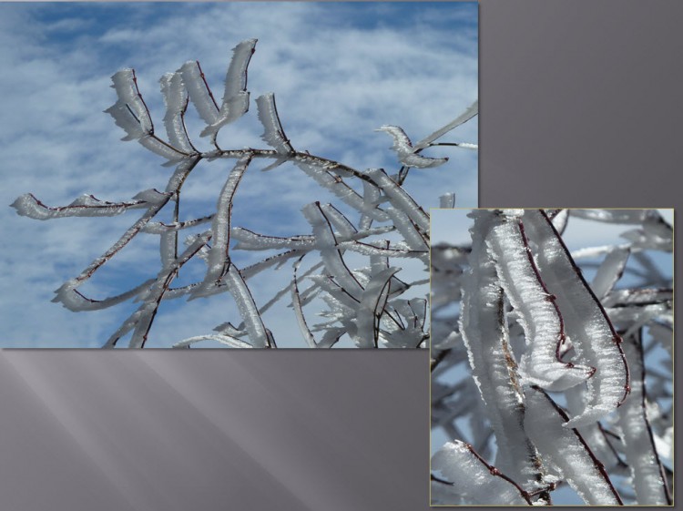
Rime ice forms on objects (trees, antennas, railings, almost anything!) when supercooled water droplets (below 32 degrees Fahrenheit) in a cloud come into contact with an object. The feathery structure of the ice grows into the wind as more droplets are deposited on the object, creating beautiful telltale structures of wind direction. The rime ice in these images formed overnight after the clear ice had developed during the day on Friday.
You can see how the rime ice formed into thin ribbons on the branches of a Japanese maple.
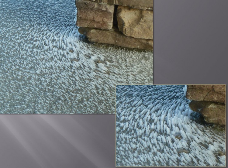
Ice as art! Below you can see where the wind flow around a stone column created a circular pattern to the deposits of rime ice.
Things change quickly!
But last week’s ice seems almost a distant memory, as we have been enjoying very warm and spring-like temperatures for the last two days. But you know what comes with spring: thunderstorms. And we’ll pay the price on Wednesday, Jan. 30, as a cold front approaches the area, firing thunderstorms as it moves through the warm air that’s in place over much of the Central and Eastern U.S.
We will likely see strong winds and locally heavy rainfall as a result of these thunderstorms. We may see some severe thunderstorms in the region — not a common occurrence in January. The National Weather Service has issued a High Wind Warning for the entire area. I would recommend that you take a moment ASAP and make sure that everything in your yard is secured so that your lawn furniture and trash cans don’t turn into missiles. The winds may also bring down trees.
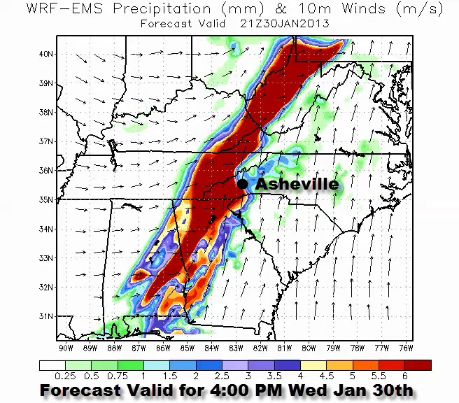
When is the worst expected: Take a look at this image from a weather forecast model valid late in the afternoon. Looks like scattered showers and storms throughout the day, with the worst of it expected late in the afternoon. Of note in the image: The dark red color indicates heavy rain and the long wind arrows indicate strong winds from the south and southeast. The wind will switch from the west as the cold front passes – but will still be very strong.
For an animation of this forecast, go to the Institute’s webpage here.
I highly recommend this website from the National Weather Service to stay aware of where the storms are. If you look now, you can already see the storms moving through the Central U.S.
Before you comment
The comments section is here to provide a platform for civil dialogue on the issues we face together as a local community. Xpress is committed to offering this platform for all voices, but when the tone of the discussion gets nasty or strays off topic, we believe many people choose not to participate. Xpress editors are determined to moderate comments to ensure a constructive interchange is maintained. All comments judged not to be in keeping with the spirit of civil discourse will be removed and repeat violators will be banned. See here for our terms of service. Thank you for being part of this effort to promote respectful discussion.