Press release from the city of Asheville:
City of Asheville partners with Waze travel app to add official traffic information
The City of Asheville today announced a data-sharing partnership with Waze (https://www.waze.com), a free, real-time traffic and navigation app crowd-sourced by drivers.
On its free mobile phone app, Waze users help each other outsmart traffic, informing each other in real-time if there’s a wreck ahead, an upcoming construction zone or whether a road is closed, for example.
As a partner with the Connected Citizens Program, Asheville will have an unprecedented look at real-time road activity, empowering City staff to harness real-time driver insights to improve congestion and make better informed planning decisions. Established as a free, two-way data share, Waze provides partners with real-time, anonymous, Waze-generated incident and slow-down information directly from the source: drivers themselves.
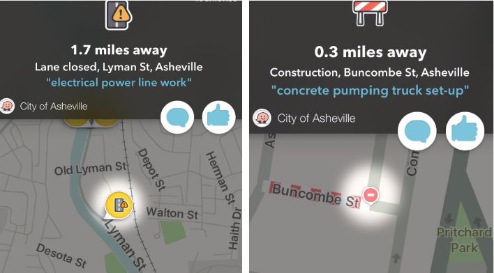
Asheville Geographic Information Systems (GIS) Programmer Analyst Christen McNamara worked with Traffic Engineering Technician Ted Williams to provide Waze with Asheville traffic information through a tailored GIS data feed from Asheville to Waze. With this feed, Waze updates City of Asheville transportation information in real time, including lane closures, street closures and permitted street construction.
“Before, Waze users would need to mark a road as closed,” said McNamara. “Now City permitted street closure information will be embedded into this existing and popular travel application.”
The Waze map evolves with every driver and data point it receives, promoting safer roads and sharing more knowledge with Wazers about potential delays to their commutes. The Connected Citizens program yields even more data, giving local citizens a greater ability to circumvent road closures and traffic jams within the app.
Whether you use Waze for holiday travel or your everyday commute, adding this official information from the City of Asheville will make it more reliable.
To find out more about Connected Citizens visit https://www.waze.com/ccp. To download the free Waze app for iOS or Android, visit https://www.waze.com/get.


Before you comment
The comments section is here to provide a platform for civil dialogue on the issues we face together as a local community. Xpress is committed to offering this platform for all voices, but when the tone of the discussion gets nasty or strays off topic, we believe many people choose not to participate. Xpress editors are determined to moderate comments to ensure a constructive interchange is maintained. All comments judged not to be in keeping with the spirit of civil discourse will be removed and repeat violators will be banned. See here for our terms of service. Thank you for being part of this effort to promote respectful discussion.