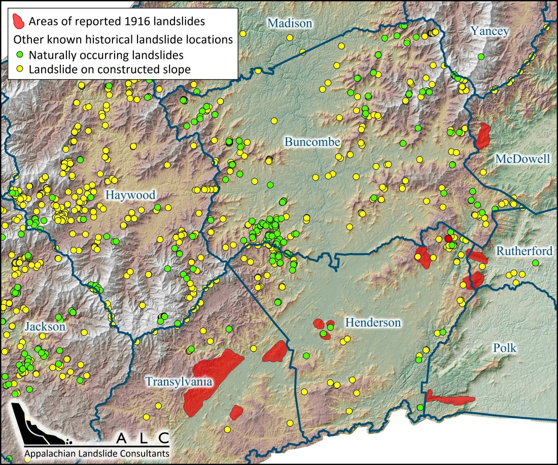
Press release from Appalachian Landslide Consultants:
Haywood County Local Emergency Planning Committee hosted a Landslide Emergency Response Meeting at the Jonathan Creek Fire Department on August 4th. The purpose of the meeting was to bring together first responders, subjects matter experts, and emergency planners to discuss the hazards, vulnerabilities and capabilities available to safely and efficiently respond to landslide incidents.
Landslide Emergency Response Planning is necessary in order to ensure the safety of WNC citizens and all responders before, during and after landslide incidents. Appalachian Landside Consultants, PLLC (ALC) has been working on mapping landslides and creating geologic stability maps for four different watersheds in Haywood County since 2012, through grant funding from area non-profit organizations. This experience put ALC in the position to discuss landslides and tools available through the mapping with the emergency managers and responders.
After an overview about landslides in Haywood County, ALC geologist Jennifer Bauer walked through examples of how the mapping can be used for hazard mitigation, planning before an emergency, and during response to a landslide incident. Attendees were given an overview of how to access the Landslide Inventory and Susceptibility maps and User’s Guide available to the public on ALC’s website (www.appalachianlandslide.com). Handouts by ALC geologist Stephen Fuemmeler prioiritized landslide inventory database fields related to relative potential for future movement of a slope, relative potential for impact to public safety should that slope fail, and relative potential impact to water quality after a failure. Emergency managers and responders can use this list to focus their attention on the areas indicated as “high” potential. “This list identifies slopes showing movement that could be repaired now, before the next big rain triggers a larger slope failure,” Jennifer explained. She then showed attendees signs of potential instability to be on the lookout for during a landslide emergency to help protect themselves and the public.
Assistant Director of Haywood County Emergency Management, Bill Miller attended the meeting. When asked about the maps, he says “As an emergency manager and responder, we must use every tool available to assist us in maintaining situational awareness. The landslide mapping data from Appalachian Landslide Consultants provide us with the information necessary for our Haywood County responders to make real time and planning decisions that allow us to be much more efficient and situationally aware. This translates to quicker response times, and most importantly, safer response options.”
One of the main objectives of the geologic stability mapping project is to increase awareness of landslides and where they occur. With increase awareness comes more informed decision making by citizens, which can help protect property, water quality, themselves, and the emergency responders that assist the community.


Before you comment
The comments section is here to provide a platform for civil dialogue on the issues we face together as a local community. Xpress is committed to offering this platform for all voices, but when the tone of the discussion gets nasty or strays off topic, we believe many people choose not to participate. Xpress editors are determined to moderate comments to ensure a constructive interchange is maintained. All comments judged not to be in keeping with the spirit of civil discourse will be removed and repeat violators will be banned. See here for our terms of service. Thank you for being part of this effort to promote respectful discussion.