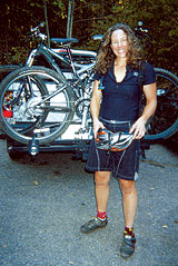
The author, ready to roll.
|
You wake up one Saturday morning knowing that you are going for a mountain-bike ride. It’s a glorious, sparkly day. The air is thick with budding roses, spicy ramps and the hum of bees in tunnels of rhododendron and laurel.
You’re headed to Laurel Mountain.
The climb up Fire Road 1206, five miles from the North Mills River Recreation Area to the Laurel Mountain trailhead, is a great warm-up for what is to come. It leaves you with a great descent back to the car as well as a full afternoon in the woods.
Catch your breath before heading onto the singletrack, because you’ll need a good lung to huff it up and over the roots on the first switchback. The trail soon flattens out for a few miles, twisting around the mountain with plenty of roots, rocks and wet rock gardens. Although this trail is often moist (it’s a rain forest, after all), my favorite time to ride it is during dry spells. The 10- to 20-foot stretch of rock gardens is a bit intimidating to traverse when wet, since the margin of error is so small. The only safety net you can count on to stop you as you slap, wallop and strike your way down the mountain, hopefully unclipped from your bike, is the saplings. It’s probably best to stay on the trail.
The last time out there, my girlfriend and I spotted each other, taking turns standing on the edge of the mountain to protect each other from a fatal plunge. My advice? Don’t be too macho to walk your bike.
The trail snakes around the mountain with an easy flow, narrow but gentle and shaded, with the sun filtering through the intricate web of leaves and branches. You snap into a larger chainring here, swishing along the packed dirt, hopping over the occasional rock or root. The trail tightens even more as you duck into the tunnels of laurel, their tiny pink-and-white petals fluttering to the ground before you like a delicate carpet and up again in the tufts of wind that swirl behind your rear wheel.
Peak experience
Glimpses of valley below show how far you’ve climbed, yet there’s higher to reach. The steepest climb lies ahead, but not before the trail dips and rolls, becoming more technical, but without the edge of the mountain to contend with. Here the laurel is so thick that you will hang stuck in it before ever coming close to the edge. Be prepared for rock drops of up to 2 feet. Although it’s most fun to hop off these with both wheels at once, it’s also possible for the faint of heart to roll gently down them.
At last you reach a steep, singletrack climb up water bars. I love to see how many water bars I can clear before I have to get off and push. It seems as though the most difficult climb is easier in the saddle than pushing the bike straight up, with the pedals whacking into my shins. I prefer resting by hanging onto a small tree near the edge of the trail to catch my breath, which eliminates the need for repeatedly clipping in and unclipping from the bike, and then pedaling on to the next helpful branch.
At the second stretch of open space, complete with logs for snacking or napping, you have a choice of which trails to take. You can drop 30 degrees northeast down Sassafras Gap and on to Big Creek — a long and very technical drop with about 13 creek crossings, so wear your wool socks in spring. If you’re not a technical rider, you will either be getting off your bike a lot or you will be a technical rider by the time you get to the Hendersonville Reservoir, up the fire road through the Trace Ridge trailhead, and back to 1206. This is a good 20-plus miles of fun, so be sure to bring plenty of water, gels and snacks.
The other, shorter choice is to press on up the next set of nasty water bars, catching the connector to the Pilot Rock Trail for a serious hike-a-bike. But the view is a phenomenal reward, complete with a rock throne for picnicking. The descent is a steep and bumpy drop littered with “babyheads” — significant rocks that provide just the right amount of thrill. If you like top speed, watch out for the 25-foot rock garden. It can be cleaned without getting off the bike, but not gracefully unless you have a bit of momentum. However, the descent is too short to be worthwhile, unless you like returning by way of the fire road after all the hard work of climbing.
Although some consider out-and-backs boring, this is certainly not true of the Laurel Mountain Trail. Heading back down requires some pedaling, but not much once you get a flow going. The rock gardens are much easier to clean, and the placement of rocks will still be fresh in your mind. It’s fast, so be sure to get your groove on.
[Bettina Freese can often be found bleeding in the woods after a particularly fun mountain-bike ride.]


Before you comment
The comments section is here to provide a platform for civil dialogue on the issues we face together as a local community. Xpress is committed to offering this platform for all voices, but when the tone of the discussion gets nasty or strays off topic, we believe many people choose not to participate. Xpress editors are determined to moderate comments to ensure a constructive interchange is maintained. All comments judged not to be in keeping with the spirit of civil discourse will be removed and repeat violators will be banned. See here for our terms of service. Thank you for being part of this effort to promote respectful discussion.