From the Institute for Climate Education at A-B Tech: It seems like it took forever to get spring going this year. The wet and cool conditions we’ve experienced during the late winter and early spring in Western North Carolina made it feel like winter just refused to leave our region. (Who can blame it? I like it here too.) But — even now — there’s a possibility of frost Thursday night (April 25)!
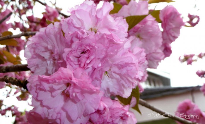
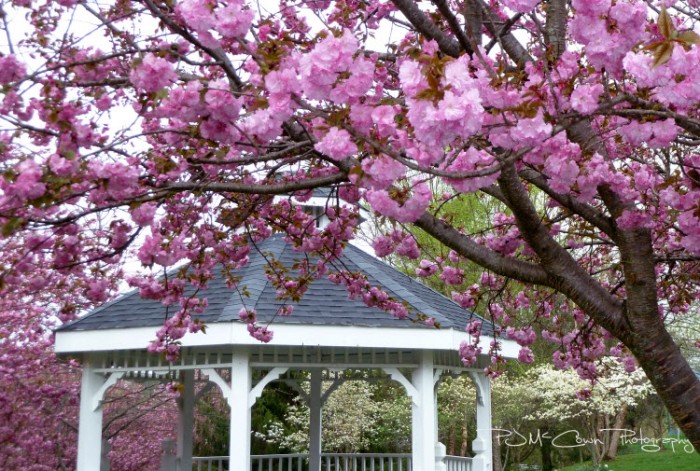
They say that good things come to those who wait, and it must be true, because many locations are enjoying gorgeous blooming trees. This beautiful scene is from Mars Hill, where the Kwanzan cherry and dogwood trees are in full bloom.


You’ll spot these Kwanzan cherry trees, also known as Japanese flowering trees, all over Asheville and surrounding communities, as they’re used quite a bit in landscaping.
You can even see the changes taking place across Western North Carolina this spring — from space!
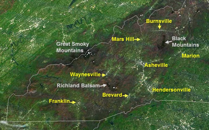
The image below is from the MODIS (or Moderate Resolution Imaging Spectroradiometer) sensor aboard NASA’s Terra satellite as it passed overhead just before 1:00 p.m. in the afternoon on Tuesday of this week.

Image credit: Image: Space Science and Engineering Center, University of Wisconsin-Madison with annotation by Pamela McCown
You can see the vibrant green of the landscape as trees and vegetation are really responding to the plentiful rainfall, increasing sun angle and warmer daytime temperatures that we have enjoyed recently. You can also see that the higher elevations are a bit behind in the greening up process with the ridge lines still showing more brown than green because many of the trees are just beginning to wake from their winter nap
Also evident, the spruce-fir forests that are isolated to the highest elevations in the Southern Appalachians. These islands of evergreens thrive at elevations over 5,500 feet, where the climate is too harsh for other trees. The dark-colored trees stand out in the satellite image above in the Black Mountains, along the Blue Ridge Parkway around Richland Balsam and in the Great Smoky Mountains National Park.
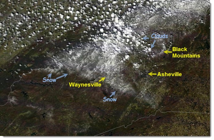
Compare the image above to the scene across the region just one month ago. The image below was produced by the same satellite on March 21. WNC had just received a quick shot of snow on that first day of spring. Aside from the triangular area of white snow and the spotty cumulus clouds – you can see that much of the region had yet to turn green with the brilliant colors that come from new leaves and growing vegetation.

Image credit: Image: Space Science and Engineering Center, University of Wisconsin-Madison with annotation by Pamela McCown
And, even though it means that we’ll be spending more time during our weekends trying to tame the jungle of growing stuff, I think it’s fair to say that most of us are really enjoying this transition into the warmer seasons.
Parting shot – Freeze Warning tonight!
So, finally! Spring looks like it is here to stay, but not without at least one last parting shot from winter. Last night’s cold front brought in some cooler air and temperatures will drop close to freezing tonight (Thurs., April 25) prompting the National Weather Service to issue a Freeze Warning for most of our area tonight and Friday morning. If you’ve got exposed tender vegetation give them a good watering this evening and cover them up to protect them from the cold.


Before you comment
The comments section is here to provide a platform for civil dialogue on the issues we face together as a local community. Xpress is committed to offering this platform for all voices, but when the tone of the discussion gets nasty or strays off topic, we believe many people choose not to participate. Xpress editors are determined to moderate comments to ensure a constructive interchange is maintained. All comments judged not to be in keeping with the spirit of civil discourse will be removed and repeat violators will be banned. See here for our terms of service. Thank you for being part of this effort to promote respectful discussion.