Eric Baden saw the opportunity to “take another issue of urgency, which has to do with care for the environment,” he says, “and the fact that, just like Asheville has a big craft community, there’s also a really important climate-based community.”

Eric Baden saw the opportunity to “take another issue of urgency, which has to do with care for the environment,” he says, “and the fact that, just like Asheville has a big craft community, there’s also a really important climate-based community.”
Take a look at Asheville’s people, population, climate, institutions, churches, wine making, factories, rent and faith in 1869.

Asheville

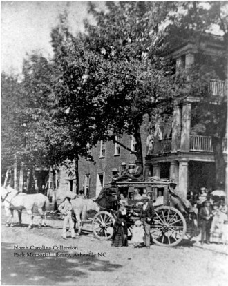
After recently unearthing (unmonumenting?) a time capsule put there in 1897 from the now-refurbished Vance monument memorial in downtown Asheville, plans to place a new capsule into the rededicated monument have been made by local officials. What insights into (now-modern/by-then-ancient) Asheville will future inhabitants of the region be able to divine?

Given the title of the talk — Zombies, Sports, and Cola: What does it mean for Communicating Weather and Climate? — Shepherd had quite a bit of explaining to do. Remarkably, however, the former NASA scientist managed to demonstrate, with these seemingly disparate subjects, how a significant portion of the public (mis)understands meteorology — and how the problem may be solved.
As you may know, Asheville is among the areas with the highest rates of unvaccinated children in the country. I’m not anti-vaccine, really I’m not. That said, I swear this whole controversy around vaccines feels to me like the secular liberal equivalent of homosexuality for conservative Christians. Of all the things the Bible in general […]
What do zombies, sports and cola have to do with the weather? On Monday, Feb. 23, Dr. Marshall Shepherd — the director for the program in atmospheric sciences at the University of Georgia — intends to tackle that question in a presentation titled “Zombies, Sports, and Cola: What does it mean for Communicating Weather and Climate?” The […]

After a two-year hiatus, local volunteers are resurrecting the TEDxAsheville conference for 2015. Featuring a diverse lineup of Asheville speakers, they hope to take the national TED slogan of cultivating “ideas worth spreading” and apply it at the local level.
For local weather wonks, the annual Western North Carolina Weather Calendar has been a must-have for decades. The 2015 version goes on sale today, Nov. 11, and marks the 30th published by the UNC Asheville Atmospheric Sciences Department. As always, the unique 12-month calendar features an assortment of Asheville updated climatological data such as monthly […]
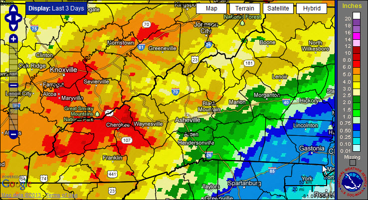
Asheville and the surrounding areas continue to see above normal rainfall during this wet spring. Now, add Tropical Storm Andrea into the mix – and you get atmospheric soup (pass the crackers!)
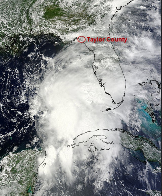
Image credit: NASA’s Terra satellite (with annotation by Pamela McC
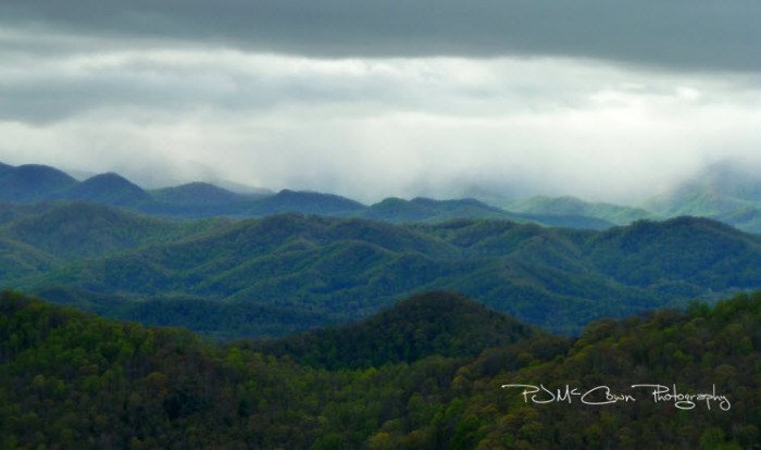
Our wet spring has helped to bring an amazing display of color across the region as the Rhododendron are in bloom across many of the higher elevations. If you’re socked in, listening to the Sunday rain, keep in mind that colorful flowers may soon follow.

Extensive rains across the region over the weekend caused numerous problems with flooded rivers, creeks, roads, downed trees and landslides. And we can look to a pesky area of low pressure that’s hanging out in our area as the instigator of all this trouble.
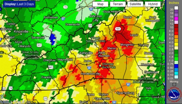
After a wet April, it looks like the large-scale weather pattern will not shift much as we head into this first week of May. And, while Asheville received above normal rainfall for the month of April, some locations west of the French Broad River Valley were soaked with over 14 inches of rain.
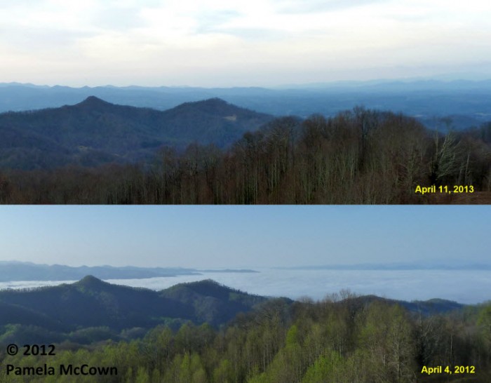
It seems like it took forever to get spring going this year. The wet and cool conditions we’ve experienced during the late winter and early spring in Western North Carolina made it feel like winter just refused to leave our region. (But — even now — there’s a possibility of frost Thursday night, April 25.) They say that good things come to those who wait, and it must be true, because many locations are enjoying gorgeous blooming trees.

It’s amazing how different each year can be as the ever-changing seasons unfold before our eyes. You may remember that the spring of 2012 was warm — very warm, with average temperatures last March that were over 9 degrees above normal in Western North Carolina. This year has been significantly different.
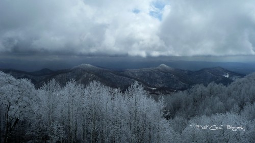
Significant snow fell again over the higher elevations earlier this week (just before Easter), which, honestly, produced too much of a good thing for many folks in the region. I could use some “hair of the dog,” or in this case, some “green of spring” to get me over this snow hangover.
A small, fast-moving and dynamic system brought snowfall to many places in the region Wednesday night, March 20. And, of course, it happened on the first day of spring!
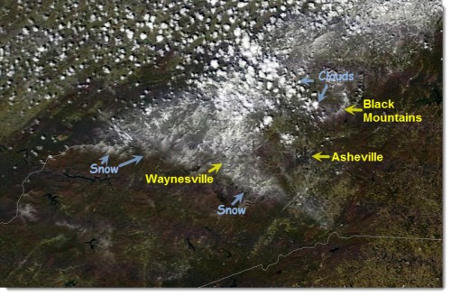
Were you part of the “haves” or the “have not-so-muchers” this week? Those who live in the higher elevations received a big dose of snow while the Asheville Regional Airport saw just a trace.
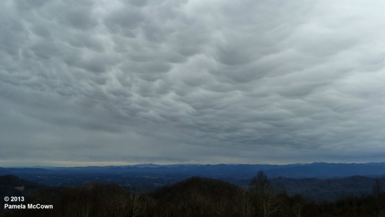
It’s fair to say that Western North Carolina has been in an active weather pattern this winter. Every few days, another system approaches the region from the west or northwest, bringing changing weather conditions. And this week was no different. Tuesday afternoon saw another one of these systems roll in and as it did, it also brought some amazing clouds that swept over the valley.
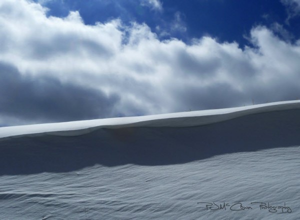
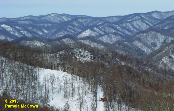
Western North Carolina can seem like a land divided at times. The complex terrain of this region has a significant impact on the climate and the type of weather that we experience at any given location. The higher elevations experienced significant snow though out the multi-day event, while many folks in the valley were left with just a few flurries.
After three days of rain, many locations in Western North Carolina have reported significant rainfall. Now, the larger-scale weather pattern appears to be shifting into a more winter-like pattern for the Eastern U.S., with a significant winter storm expected later today and arctic air moving in over the weekend. So, hold on: It looks like it’s going to be a bumpy ride!