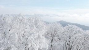
A winter weather advisory has been issued for the Western North Carolina mountains today, Dec. 7, beginning at 4 p.m. and running until 7 a.m. tomorrow morning, bringing the prospect of freezing precipitation and black ice on roads and other surfaces, especially at higher elevations, during the evening and overnight.
And last night — as if on cue — NOAA meteorologist Tom Ross presented a look at the long-range winter forecast for WNC in a public lecture at A-B Tech, hosted by the college’s Institute for Climate Education. The question on many folks’ minds: Will Ashevillians get socked with extreme winter weather this year, or are the forces of nature expected to produce a mild season?
“Meteorologists are thick-skinned,” Ross said as he launched his talk, “so go ahead and throw your tomatoes. We take the blame for a lot of people’s wrong forecasts.”
And while admitting that forecasting is as much art as science, Ross argued that the tools of the trade have come a long way in the years since he started out, when cold fronts were plotted by hand on large paper maps, using data collected by weather stations across large areas of the continental U.S.
Thanks to high-speed computers that use the latest algorithms to interpret atmospheric patterns around the globe, modern weather forecasts use real-time animations to show the advancing fronts, and highlight precipitation and other events at very fine scales. But long-range predictions?
It turns out that those still depend on a pair of well-known, annual atmospheric patterns on Earth, known as “El Niño” and “La Niña.” In El Niño years, global weather forces tend to bring wet and cold conditions to WNC (and the eastern U.S. in general). Meanwhile, in La Niña years, atmospheric conditions around the planet tend to drive drier, warmer winter weather here.
Atmospheric data collected at NOAA this year indicate we’re in for La Niña warming effects. AccuWeather and the Farmer’s Almanac support the same conclusion: a relatively mild winter in WNC this year, with the worst winter weather staying focused well to the north, the upper Midwest, the Great Lakes and Canada.
But of course, there are qualifications and hedging. “Elevation is an important factor for weather in WNC,” Ross pointed out. The difference in weather between 2,000 feet and 4,000 feet can be extreme, he said; same for conditions on the eastern versus western sides of our long mountain ridges. Add basic weather phenomena such as cold air damming — when cold air sweeps into the region from the northeast and accumulates against the eastern side of our mountains — and the result can be local conditions that are treacherous.
Or consider another major winter phenomenon here: “Gulf lows” that transport warmer, moist air from the Gulf of Mexico to WNC, where it meets colder air from the north and dumps quantities of snow when it hits the mountains. The big snows in WNC last Christmas and again in January 2011, were both produced by Gulf lows.
Then there’s the possibility of “northwesterly” snow events: Cool air following a cold front moves in from the northwest and dumps snow as it’s forced to rise and cross the mountains. Air cools as it rises, and cooler air can’t hold as much moisture, so the result is a deposit of the fluffy white stuff — or hail, which is produced when drops of precipitation are batted back and forth by the wind across a line of freezing air aloft, like a ping-pong match, allowing concentric rings of freezing water to accumulate as little balls or disks, which eventually fall to the surface.
Even so, most of the time, seasonal snowfall in WNC amounts to 15 inches or less, Ross said.
So what’s Ross’s forecast for winter in WNC this year? For December through March, Ross says, “No major snow until after Christmas. It’ll alternate with periods of warm then cold, wet then dry after that.” He predicts above-average snowfall, perhaps surpassing that benchmark of 15 inches this season.
“The bonus is, winter doesn’t last long around here,” Ross says, grinning. “It ebbs and flows.” If you don’t like the weather this morning, he suggested, just wait around until afternoon, when it will likely change.
“Forecasting is like baking a cake,” Ross told the crowd. “There are so many ingredients going into it, it’s hard to predict” how changing one ingredient can impact the result. “When you come right down to it, only God knows for sure.”


Well done son love mom