From the Institute for Climate Education at A-B Tech:
One of the most amazing transformations in nature is on display right here in Western North Carolina as trees and vegetation come alive in the spring. This process occurs over a period of time with the lower elevations “greening up” first. The flush of color then moves up the mountains where the highest elevations are the last to fill out, thanks to generally lower temperatures at the higher elevations.
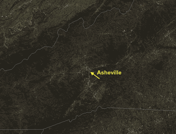
While it has been green in the valley for quite a while, the hardwood trees at the higher elevations (4,000 feet and above) are still in the process of waking up from winter. This transformation is visible thanks to NASA’s Aqua Satellite, part of the Earth Observing System that allows us to monitor the Earth. The image below was taken on March 1, 2012 — a beautifully clear day that allowed a clear view of the brown, pre-spring landscape.

Image Credit: NASA and the Space Science and Engineering Center at the University of Wisconsin-Madison.
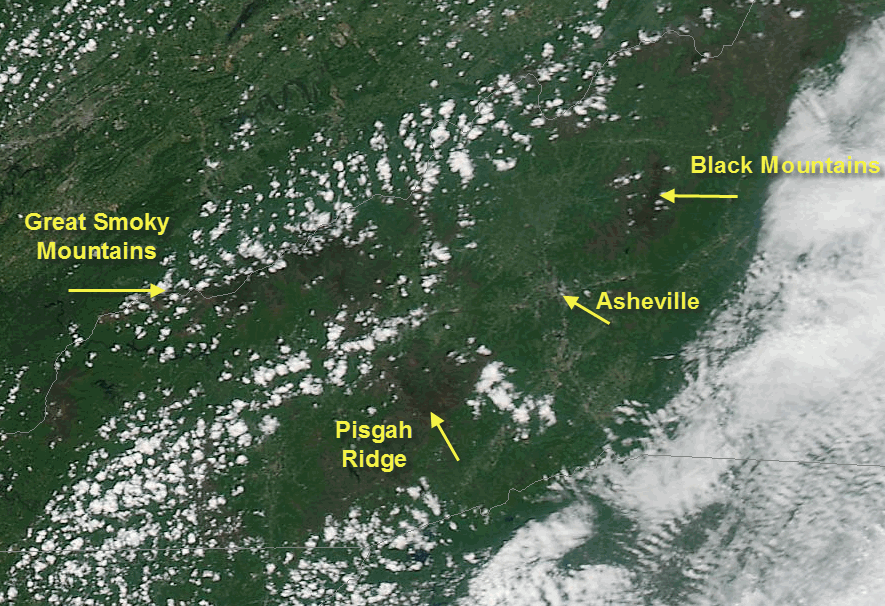
By last week (April 28), the landscape had transformed into a lush green spring paradise seen in the image below, with the exception of the higher elevations, which still appear brown. At the highest elevations (above about 5,500 feet), the spruce-fir forests dominate the landscape where conditions can be too harsh for broad-leaf trees.

Image Credit: NASA and the Space Science and Engineering Center (SSEC) at the University of Wisconsin-Madison.
The WNC forests play an important role in our local climate and even our daily weather conditions. The green vegetation helps to hold moisture in the soil by shading the forest floor. But the plants also transpire significant amount of water vapor into the atmosphere, making muggy air and the puffy cumulus clouds seen in the picture above an almost daily occurrence. This added moisture also helps to aid in the formation of the afternoon thunderstorms that we see in the mountains during the warm months.
Join us on Saturday, June 2, for a free severe weather workshop. The Institute is hosting Basic and Advanced Skywarn severe weather spotter training by the National Weather Service from 9:30 am – 2:30 pm. Details on registration will be available next week on the Institute’s web site, here.


Before you comment
The comments section is here to provide a platform for civil dialogue on the issues we face together as a local community. Xpress is committed to offering this platform for all voices, but when the tone of the discussion gets nasty or strays off topic, we believe many people choose not to participate. Xpress editors are determined to moderate comments to ensure a constructive interchange is maintained. All comments judged not to be in keeping with the spirit of civil discourse will be removed and repeat violators will be banned. See here for our terms of service. Thank you for being part of this effort to promote respectful discussion.