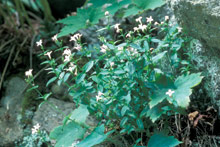
Mars Hill College students help conserve endangered bluets
The mission is simple yet daunting: Save the Roan Mountain bluet (Hedyotis purpurea var. montana). From May through September, the rare flower peeks out of rock crevices and gravelly soils at high elevations around Roan Mountain. But the endangered species, found in a mere five Western North Carolina counties (and one in Tennessee), has sparked a rescue mission by a group of Mars Hill College students armed with computers.

In order to save the bluet, however, you first have to find it. In the 1990s, the U.S. Fish and Wildlife Service hired a subcontractor who visited known bluet sites. He cataloged the plants he found, what conditions threatened them and other details. But this information now resides in a hard-to-use pile of data-collection forms and a stack of topographic maps with dots marking bluet sites, says Carolyn Wells, a botanist with the federal agency.
Enter the college kids and Mars Hill professor Scott Pearson, who teaches a course called “Introduction to Geographic Information Systems.” As a class project, they’re converting the 1990s data into a GIS format that “will improve our access to [it] and our ability to share it,” says Wells.
“It’s really helpful to me, as a botanist, to have the students engaged in this project, and I truly believe that they’re contributing to the recovery of this plant,” she notes.
Wells, who monitors many of the 18 endangered or threatened plant species found in Western North Carolina, explains that the Roan Mountain bluet is found at only a handful of sites, most of them above 5,000 feet. The hardy plant favors rocky summits characterized by cold, fog and winds of up to 100 mph. But that’s only the beginning. Trampling by hikers who stray off marked trails poses a threat. So do exotic species and, probably, air pollution and climate change, continues Wells.
On Oct. 7, the GIS students joined Wells on a mountaintop field trip, so they could see the bluet in its natural habitat. Some students remarked that they had rarely hiked the region’s higher elevations. “They were [also] surprised at the plants that grow in such extreme conditions,” she recalls. Seeing those conditions firsthand also underscored how hard it is to re-seed species like the bluet.
Back in the classroom, Pearson’s students will take the 1990s paper data and turn it into a digital GIS file, enabling scientists to project a computerized map showing all the sites. They’ll also be able to call up information for each site, such as habitat type, elevation, area and number of plants, says Wells.
In addition, digitizing the bluet data will make it possible for scientists to overlay other spatial information, such as target sites of proposed U.S. Forest Service prescribed fires, or areas where development is likely to occur. This will help land managers, environmentalists, nonprofits and others determine conservation priorities and strategies. Furthermore, the conversion will facilitate data sharing with the North Carolina Natural Heritage Program, a repository of information on rare and imperiled species in the state.
“It’s exciting when something in the classroom has real-world applications,” notes Wells. And speaking of the real world, she concludes, “If you go up to a high elevation and find a short plant that looks like a bluet but its flowers are larger and more purple, give me a call.”


Before you comment
The comments section is here to provide a platform for civil dialogue on the issues we face together as a local community. Xpress is committed to offering this platform for all voices, but when the tone of the discussion gets nasty or strays off topic, we believe many people choose not to participate. Xpress editors are determined to moderate comments to ensure a constructive interchange is maintained. All comments judged not to be in keeping with the spirit of civil discourse will be removed and repeat violators will be banned. See here for our terms of service. Thank you for being part of this effort to promote respectful discussion.