By Jack Igelman, originally published by Carolina Public Press. Carolina Public Press is an independent, in-depth and investigative nonprofit news service for North Carolina.
Editor’s note: This article is part 1 of the five-part in-depth series Fraught Forests from Carolina Public Press, which examines the challenges of climate change for Western North Carolina’s mountain forests.
Unusual periods of drought, with heightened risk for wildfires, damage the health of Blue Ridge Mountain forests in Western North Carolina. At the opposite extreme, intense rainfall events cause erosion, landslides, flooding and other damage to forests and surrounding areas.
When these erratic cycles follow one another with greater frequency and intensity, along with extreme swings in hot and cold temperatures, the forest ecology experiences a destabilizing whipsaw effect.
Humans trying to manage these vast forests, whether on private or public lands, face an unprecedented challenge as climate change promotes such chaos. Plant and animal species that reside and rely on the forests, including increasing numbers of human residents, experience the disruption of these unpredictable weather events in the forests.
More subtle, but also insidious, average daytime maximum temperatures and nighttime minimum temperatures continue rising well above the levels seen a few decades ago, shifting the habitable zone for key species that have lived in the forests for thousands of years, while opening the door to invasive species that threaten the woodland region’s continued existence.
Scientists, forest managers and environmental advocates are all trying to get a handle on what’s at risk in the Western North Carolina forests due to climate change and other factors, as well as what they can do about it.
Thirsty trees in dry times
How much trees drink makes a difference, especially at the highest elevations and ridge tops of the Southern Appalachians. When it rains, trees absorb water through roots, where they store and transport moisture via a complex network of tissue, releasing water vapor into the atmosphere from needles or the surface of leaves.
But what happens to a tree’s appetite during periods of drought in what has typically been one of the Southeast’s soggiest ecosystems?
The answer is that ridge-top forests are particularly greedy drinkers when it’s dry, according to three N.C. State University researchers in the Department of Forestry and Environmental Resources — doctoral student and lead researcher Katie McQuillan, and faculty co-authors Katherine Martin and Mirela Tulbure, who recently published their results in the journal Landscape Ecology.
Using satellite imagery to examine how forest water use changed over time in the Blue Ridge ecoregion, they discovered that high-elevation and ridge-top forests capitalize on first access to precipitation.
Ridge crests and the highest elevations of the state’s western forests are just two of many microclimates and forest ecosystems altered by climate change. A warmer climate, experts predict, will likely bring greater weather variability with potentially high rainfall events interrupted by longer dry spells.
The impact on forests, however, is not solely an ecological problem. An ecosystem stressed by a more extreme climate will reshape how people live near forests, how they recreate and how they interact with the species that inhabit the woodscape of WNC.
“One of the factors that influence how much water a forest uses is how hot it is outside,” McQuillan told Carolina Public Press. “So, when it’s hotter, the forest needs more water to continue to be happy and productive.”
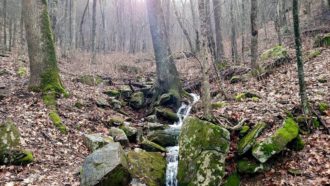
Tree species accustomed to cooler conditions that are capable of guzzling water at a high rate “don’t care how much water is available; they’re going to continue using as much as they need until it runs out,” she said.
The fallout may be less water available to run downstream and quench the thirst of lower-elevation forests, aquatic biodiversity and potentially exacerbate the effects on downstream communities that rely on a steady flow of water to drink, for recreation, energy or agriculture.
If trees devour more water when it’s parched, “it’s a signal that they’re stressed,” Martin said. This will expose communities at the edge of the forest to the fallout of erratic weather events.
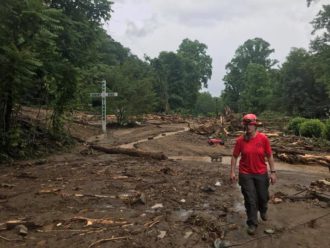
Look back no further than Aug. 17, 2021, when the remnants of Tropical Storm Fred, which had formed over the Gulf of Mexico, settled over the high ridges of Haywood County, unleashing 14 inches of rain in 12 hours.
Cruso, a small unincorporated community on the East Fork of the Pigeon River, was hardest hit.
Previous climate change research has predicted more frequent and more powerful tropical weather systems with more hitting land and doing substantial damage, including far inland.
Regardless of how much climate change contributed to this particular storm, the ecology of WNC’s forests is delicate and, due to climate change and other factors, out of step with its natural order.
Beyond the old preservation narrative
A century ago, protection of the forests in WNC emerged from renegade logging that nearly decimated the area. Advocates for forest conservation heralded this initiative as a monumental environmental victory.
Today, however, the struggle to protect forests from industrial-scale logging is over. Instead, attention is focused on how to manage and restore both private and public forests.
According to the N.C. State Extension Forestry, 68% of the land throughout 24 Western North Carolina counties is forested. Among the forests of WNC, 69% of forest land is privately owned, and 31% is publicly owned.
Yet, despite North Carolina’s mountain counties having some of the largest, relatively unfragmented swaths of forestland in the Eastern United States, a wide range of alarms is sounding regarding their overall well-being.
Experts are concerned about fire suppression, invasive pests, lack of forest-age diversity and land use pressure.
Extreme weather whiplash
The potential for a one-two punch of drought-related wildfires followed by tropical rain systems that track over the mountains is worrisome not only for forest health but also for the growing numbers of people who reside near the forests and at their edges.
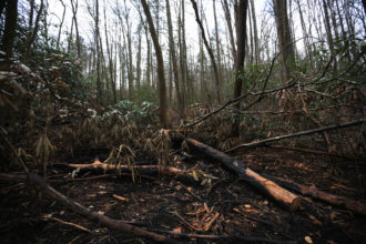
In 2004, the remnants of hurricanes Frances and Ivan passed through the region, triggering more than 400 landslides. And in 2016, 51 wildfires burned more 50,000 acres throughout the mountains.
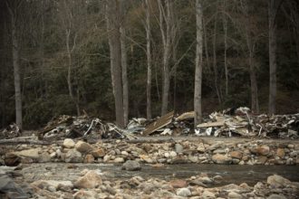
More recently, according to a National Weather Service report, 8 inches of rain fell in two to three hours at the headwaters of the Pigeon River in the upper elevations of the Balsam Range. A stream gauge on the East Fork in Cruso exceeded its highest mark by more than 3 feet, surging more than 2.5 feet in 30 minutes, leading to flash floods and triggering landslides.
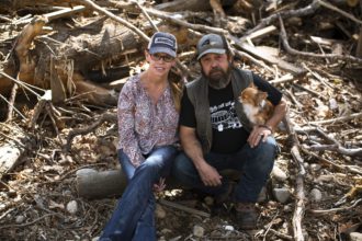
Cruso resident Steve Chaney barely evaded the flood as two branches of Hungry Creek that encase his home overflowed. The storm forced the rescue of dozens of people. Flash flooding in Cruso swept away homes, washed over bridges and claimed the lives of six.
Boulders the size of a truck rolled down the mountain like marbles, and he witnessed mobile homes demolished by the savage hydraulics of a flash flood, said Chaney, whose home incurred significant damage.
“I’ve never seen anything like it,” he said.
David Easterling, chief of the scientific services division at the National Oceanic and Atmospheric Administration’s National Climatic Data Center in Asheville, told CPP that the high elevations and ridge tops of the forest receive the most rain from the remnants of tropical storms and hurricanes.
While scientists have not yet studied Tropical Storm Fred closely, careful examination of Hurricane Harvey, which battered Houston in 2017, was 20% more intense due to a warmer climate, Easterling said.
“My expectation, based on the science, is that climate change made Fred more intense by an order of 2 or 3 additional inches,” he said. Easterling is a co-author of the N.C. Climate Science Report released in March 2020.
“That’s speculation, of course, but the expectation in the future is that when storms occur, they will be more intense in terms of rainfall due to a warmer atmosphere,” he said.
“As the atmosphere warms, it can hold more moisture, so when they do occur, they will be more powerful and lead to more frequent and stronger flash floods.”
Long-term warming
Ultimately, the intensity of future storms and the warming trend depends on how much more greenhouse gas is pumped into the atmosphere in the future.
Business as usual, said Easterling, means anywhere from 2 to 5 degrees of temperature rise by 2050 in North Carolina. Technological adaptations and other mitigation strategies, he said, would put less pressure on temperature, “but that’s if we start taking climate change seriously.”
Globally, the average surface temperature has increased by almost 2 degrees Fahrenheit since 1900. In North Carolina, the average temperature has warmed by 1 degree since 1900.
Increases in warming have accelerated since the mid-20th century and track closely with a rise in the output of greenhouse gases — such as carbon dioxide and methane — into the atmosphere.
The average overall temperature in the mountains has increased by roughly a degree in temperature, Easterling said. More notable: Nights aren’t as cool.
In Brevard, for example, the observed average minimum temperature between 1961 and 1990 was 40.8 degrees. Models project a minimum temperature of 44.7 degrees based on a lower emissions model and a higher end of 45.8 by 2050. By the end of the century, the projected average minimum temperature could reach nearly 50 degrees in Brevard.
Scalding days will also be more common. For example, between 1960 and 1991, Buncombe County averaged 2.6 days with a high temperature exceeding 90 degrees. By 2030, models predict between 23 and 32 days above 90 degrees. By 2100, it will be up to 79 days.
When minimum temperatures aren’t sufficiently cool, it can trigger public health issues, ecosystem changes, greater energy consumption and stress on infrastructure. Periods of high temperatures also limit the chance for plants and animals to recover from daytime heat.
“Our understanding of the climate system is that as you increase greenhouse gases, there are all sorts of changes you’re going to see,” Easterling said. That includes more droughts.
While dry spells may not be more frequent, they may intensify more rapidly and persist longer.
During dry periods, temperatures rise faster, which accelerates evaporation and dries soils and vegetation, locking them into a longer and drier cycle of weather.
The result of warmer and drier periods increases the likelihood of wildfires and other catastrophic events that may take advantage of an unhealthy ecosystem.
“It’s really the same thing as a hurricane,” Easterling said. “These extreme events will become more variable, if not necessarily more common. People will have to be prepared and learn to adapt.”
More rain, more people
Recognizing the challenges that such intense rainfall poses for potential flooding and water damage, the Brevard City Council designated $670,000 of its American Rescue Plan Act funding toward enhancing the city’s outdated stormwater infrastructure.
According to the National Centers for Environmental Information, roughly 413 inches of rain fell in Transylvania County from June 2017 to December 2021, making it the wettest county in the state for that period. Brevard, the county seat, lies on the boundary of Pisgah National Forest.
In addition to more rain, more people — both visitors and residents — are landing in Transylvania County. While much of Western North Carolina remains rural, the five counties surrounding Asheville, including Transylvania, are expected to exceed a combined population of 600,000 by 2040.
“Changing climate is one of the stressors to the region, but development and land use conversion are another,” said Jim Fox, the former director of UNC Asheville’s National Environmental Modeling and Analysis Center, or NEMAC.
“We can’t continue to treat our forests badly if we want them to keep providing the ecological services we want,” he said. That includes clean water, carbon storage, flood control, clean air and recreation.
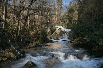
Addressing the ecological obstacles within the forest represents a difficult-to-solve challenge.
A centerpiece of the recently completed land management plan for Pisgah and Nantahala national forests is their ecological restoration.
Fox said the decadelong revision process demonstrated that environmental, economic and cultural values vary dramatically throughout the North Carolina mountains. Pisgah and Nantahala national forests span 18 counties and include more than 1 million acres of forest.
Historically, public forest land ownership in the Eastern United States was largely determined by acquisition opportunities, which began with the first national forest purchase in North Carolina in 1916.
The result: Numerous small towns, roads, infrastructure and communities are within and surrounded by national forests. Therefore, the communities and the people of Western North Carolina have close economic, political and cultural relationships with the national forests.
That makes a one-fit forest plan really challenging and puts competing values in place, Fox said.
Tough choices
A persistent tension in the forest plan is that opening land for timber harvesting or other forest prescriptions may come at the expense of other values, such as land preservation or recreation. Alternatively, land protection designations, such as wilderness, may overly restrict the ability to harvest trees for restoration or economic purposes.
“If you ask people to vote for the quality of the forest or to protect their own home against wildfire, most people then start voting for protecting their home against wildfire,” he said. “Decisions are all very local.”
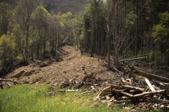
Fox is particularly concerned with the land interface between forest and development where people live, in which nature has no regard for whether a mountain slope is within a national forest or beyond it.
“The more we start engineering those slopes to meet our needs for living, then the more damage we start doing to the integrity of the natural system,” he said.
For instance, healthy forests hold the soil in place, and deep-rooted native trees are more resilient and contribute to slope stability, preventing some landslides.
“Land use may compound the damage we do to ourselves as humans living in this interface with nature,” Fox said.
“We’ve got early warning systems for floods and storms. But if you live higher up in the watershed, all bets are off.”
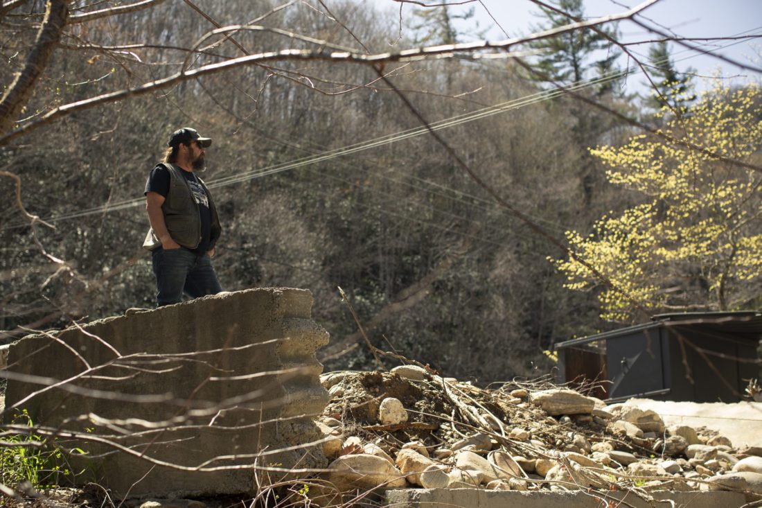
Meanwhile, in Cruso, debris from Fred’s wrath is still awaiting removal.
Many residents rebuilt exactly where their homes once were, Chaney said. Some may not have the resources, or perhaps, the desire to leave the tightknit community.
“I’ve lived all over the world, but I’m telling you, these are the damn toughest people I’ve ever met,” he said. “This is the first place that I can ever say that I’m proud to call home.”
Nevertheless, Fred was a big wake-up call, Chaney said.
“We need to think about our environment,” he said. “And we need to think about what we’re doing to it. You can’t just keep taking from this Earth and expect it to keep giving.”


Before you comment
The comments section is here to provide a platform for civil dialogue on the issues we face together as a local community. Xpress is committed to offering this platform for all voices, but when the tone of the discussion gets nasty or strays off topic, we believe many people choose not to participate. Xpress editors are determined to moderate comments to ensure a constructive interchange is maintained. All comments judged not to be in keeping with the spirit of civil discourse will be removed and repeat violators will be banned. See here for our terms of service. Thank you for being part of this effort to promote respectful discussion.