Some days, what’s most likely to take your breath away on a hiking trip in Bent Creek Experimental Forest or on the Mountains-to-Sea Trail is visible before you even get out of your vehicle.
That many Subarus and Toyota Priuses with “Tree-Hugging Dirt Worshipper” or “Hike Naked” bumper stickers shouldn’t fit into one trailhead parking lot or pull-off — and yet, amazingly, there they are.
It’s great that so many people want to get outdoors. It’s not so great for your desire to get away from it all that they want to visit the same stretch of woods you do, all at the same time.
But some places in Buncombe County still offer outdoors solitude without a lengthy drive to Great Smoky Mountains National Park or an obscure corner of Pisgah National Forest. The following guide lists destinations close to home where you typically won’t meet someone at every turn.
Shope Creek
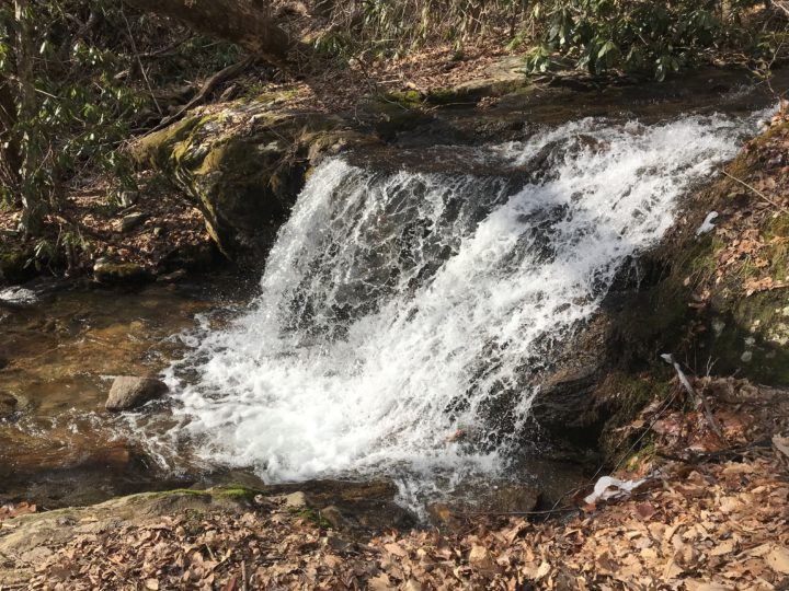
This roughly 1,600-acre valley in the Riceville area has small waterfalls, older trees in its upper reaches and a network of mostly unofficial trails on Pisgah National Forest land.
You’ll park in an area that was logged just a few years ago. Head uphill on the old logging road, and the scenery gets better and better as you go. After about a mile, a side trail leads a short distance to the right (east) to Forrest Falls, or you can stay straight to climb to the top of a ridge and a T-intersection with the unofficial Rock Payne Trail.
At this point, the Blue Ridge Parkway is about half a mile to your left (north). You can return to the parking area via a 2-mile steep ridgeline hike to your right with some nice views, or just turn around and use some of the other trails to make an easier loop back to your vehicle.
Online maps show a waterfall or two at the end of a trail up Wolf Branch to the northwest of the parking lot. The path traverses a large cutover area, and the waterfall closest to the trail is not worth the trip.
Getting there. The main trailhead, at the end of Shope Creek Road, is less than a 15-minute drive from Asheville’s Charles George VA Medical Center. Where the pavement ends, cross the creek on a concrete ford. The parking lot is a few yards ahead.
Navigating. The local www.hikewnc.info website and outdoor gear retailer REI’s www.hikingproject.com both have information and maps for Shope Creek. The most detailed coverage is on Hike WNC.
Warren Wilson College
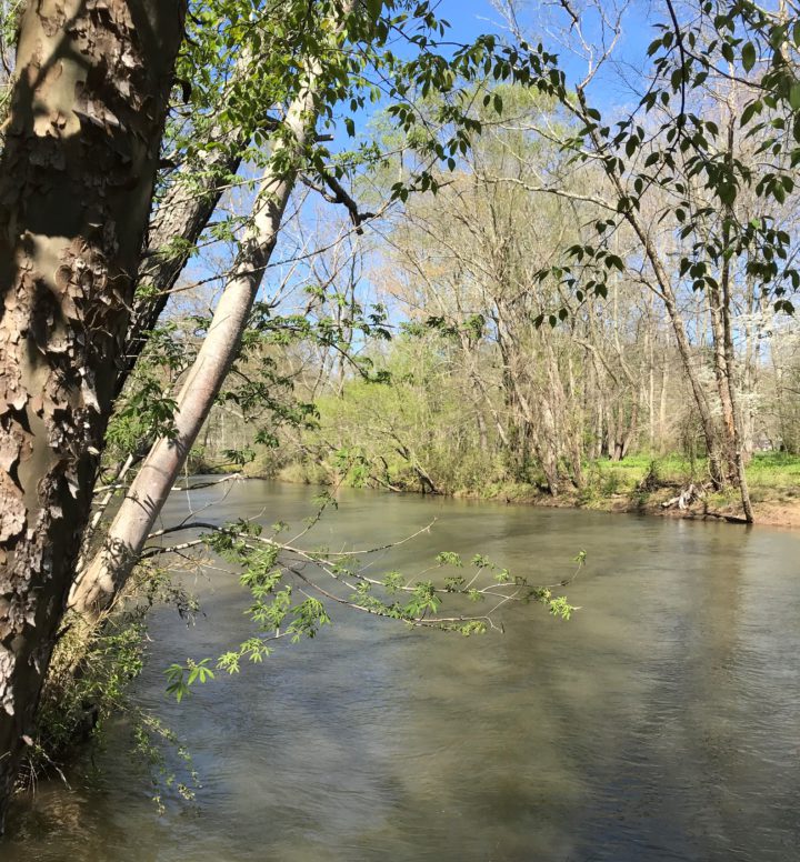
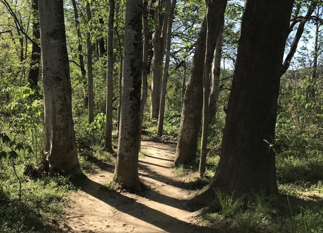
The Swannanoa school has 25 miles of hiking trails. Two nearly flat ones wind through a strip of large sycamores, buckeyes and other trees along the north side of the Swannanoa River for about 2 miles. The paths lie next to the college’s farm fields, which are off-limits to visitors.
You’ll find the main River Trail West and River Trail East trailhead where Warren Wilson Road crosses the river. No parking is available there, so you’ll have to find a visitor parking space on campus. River Trail West dips into more remote, wooded areas and is the prettier of the two.
River Trail East’s other end is in Buncombe County’s Charles D. Owen Park. Look for a small, unmarked grassy slope at the west end of the park’s lower pond. The trail immediately crosses a small bridge, then a powerline right of way.
Getting there. The trails are in three main areas: In and around the campus, the Jones Mountain area half a mile south on Warren Wilson Road and the Berea area across Riceville Road from Berea Baptist Church. Park only where allowed and don’t block gates.
Navigating. A Google search for “Warren Wilson College trails” will turn up maps in several places.
YMCA Blue Ridge Assembly
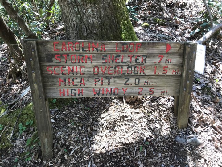
South of Black Mountain, this conference and retreat center features a well-marked network of 15-20 miles of trails in an enclosed valley that rises to the high ridge that separates the Swannanoa Valley and Fairview.
Most notable is High Windy Trail, which rises 1,600 feet over 2.5 steep miles to the peak of the same name and a great view of the Swannanoa Valley and Craggy Mountains. A gentler option is Carolina Loop. After parting company with High Windy Trail about a third of the way up, it runs through a cove hardwood forest likely to have plenty of wildflowers in early to mid-May.
Getting there. The center is located at 84 Blue Ridge Assembly Road, Black Mountain. Turn off Blue Ridge Road, which runs between N.C. 9 and U.S. 70 on the southwest side of town.
Navigating. Before you start walking, park on the uphill side of the Blue Ridge Center main building, go inside and ask for a free trail map at the front desk. Note its instructions about where to park.
Montreat
More than 40 miles of trails are maintained by the Montreat Conference Center. They’re no secret, but there is enough room to get away from the crowds.
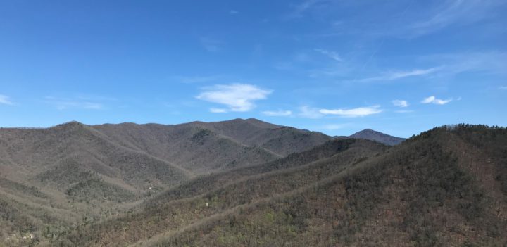
There are great views to be had from a rock outcropping on Lookout Mountain. The way up for normal people is to take the easy, 1.8-mile Rainbow Road trail, then climb steeply for about 1,000 feet on Lookout Trail. Those who think using a StairMaster is a fun workout can get there more directly by starting at the bottom of Lookout Trail and climbing for roughly 0.4 miles. Combine the two routes for a loop.
Old Mitchell Toll Road is a roadbed used by tourists decades ago to drive from Black Mountain to Mount Mitchell, with grades easy enough for a Model T. The classic Montreat hike is the 8.8-mile round trip on Graybeard Trail to the summit of Graybeard Mountain at 5,408 feet in elevation.
Getting there. Take N.C. 9 north from Interstate 40.
Navigating. A small but useful map of the trail system is available at the “Wilderness” section of montreat.org. Area outfitters sell an excellent “Black Mountain” map put out by Pisgah Map Co. with much more detailed trail information.
Collier Cove Nature Preserve
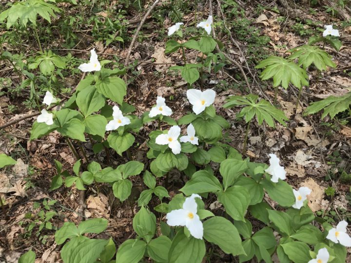
Buncombe County’s map of this park in Arden warns its trails are “steep and rigorous.” The caution isn’t just to provide a little protection in case someone gets hurt and decides to sue: The 29-acre park boasts a nearly 500-foot change in elevation. Three of the trails — Trillium Trail, Walnut Way and Sassafras Circle — are indeed steep.
That and a rainy forecast may explain why there was only one other vehicle in the parking lot when I visited on a pleasant Saturday morning in mid-April. Still, the 2 miles of trails are certainly walkable — go slow — and at the right time of year are lined with thousands of wildflowers. Large-flowered trillium and other blooms blanketed the slopes during my visit.
Getting there. Collier Cove is at the top of the Royal Pines neighborhood. Ask your smartphone for directions to 194 Rhododendron Drive, Arden. There is also an entrance, but no parking allowed, at the end of Deseret Drive.
Navigating. There is a trail map on the parks section of www.buncombecounty.org and on a sign in the parking lot.
Edited 5/6/19 at 2:40 p.m. to reflect parking access restrictions at one location.


Not Hidden anymore! Thanks a lot for inviting MORE people into these “HIDDEN” gems. Their natural beauty is already being compromised thanks to social media. The last thing we need is to invite the rest of world into lesser known areas. This only contributes to the decline of peaceful NOT yet abused and trashed areas. I have watched the starting decline of the trails, trail side plants , and abundance of wild life in the Shope Creek and Warren Wilson areas thanks to the multitudes that now go there. There are so few undiscovered places left in our county, and articles like this aren’t helping. What a shame…
While I definitely don’t agree with the publication of these hike details, I’d invite you rethink your stance a little. You are not the only one entitled to know about or visit these areas. Whether we like it or not, outdoor culture is growing and more people want to get outside. Nature belongs to everyone, not just those who are lucky enough to know where the “good spots” are.
And if you’re so concerned with the potential destruction and trashing of these areas, then why not head up a group to do trash pick-up monthly? Start a blog to educate readers on how to behave outdoors? We ALL have a right to outside just as we all have a responsibility to take care of it.
Although I hope this isn’t the effect, I am concerned that after this article (and others like it) these “hidden” places will become so publicized that they are just as crowded as any of the well known hiking areas around Asheville. There is a serious irony to this, as the hidden gems will now become the very overcrowded places described at the beginning of the article. Places like Shope Creek are already seeing record numbers this year and these formerly pristine areas will soon become over trafficked. There will have to be a follow-up story in two years about how sick we are of Shope Creek because of how many priuses are parked out front, and all the even lesser known places we can overcrowd. It is fine to have this information spread naturally through word of mouth, but do we really need an article exposing the last few lesser-known wild spots to the masses, including hoards of tourists?
I never considered the Warren Wilson College trail “hidden”. I hiked it frequently and saw MANY others on it. In the last two years, usage has dropped as portions have been washed out by floods and the popular parking space where Warren Wilson Road crosses the river has been fenced off. I am not sure if the trail is even open now.
To an extent, I understand the desire not to run into other people around every curve or to have a place all to yourself. And, there are places that do get too many visitors. Nonetheless, I disagree with those who suggest it would have been better had I not written this article. The evidence I saw does not suggest that any of the places I described are being “loved to death.”
Before writing this article, I hiked in each of the places described either once or twice this year. (I had also hiked in all but two in previous years.) Except for the Lookout Trail in Montreat, I saw fewer than a dozen people on each trip. On two trips, I saw no other hikers. It’s true that there were more signs of visitor use in Shope Creek this year than I saw several years ago, but I did not see signs of excessive erosion or trash there or at any of the places I visited.
Second, the article will encourage some people to either make a trip outdoors they wouldn’t have made otherwise and others to visit these areas instead of more crowded places like Bent Creek, parts of the Mountains-to-Sea Trail or Asheville’s Richmond Hill Park, which I visited but chose not to include in this article. Those are beneficial decisions for those making them and the rest of us. It is well documented that Americans do not get enough exercise, and doctors are even prescribing trips into the outdoors for people, as recently reported by Outside magazine. Reducing pressure on Bent Creek and similar areas is a good thing and I highly doubt any of the places in the article will be overrun in two years.
I have a hard time with the argument that the only way people should be able to learn about public lands like Shope Creek is by word of mouth. We all own upper Beaverdam Creek, Shope Creek and Collier Cove Nature Preserve, not just those who are in the know. That even includes tourists, in the case of U.S. Forest Service land, although I doubt there are many people who live outside the region and would choose to visit because they read this story, unless perhaps they were considering an AirBandB in Montreat. If you are coming to the mountains to go hiking, most of these places would not be at the top of your list. Their appeal is more for locals looking for someplace close by to get outside or someone visiting for other purposes who also wants to get a hike in.
Just a note about Warren Wilson trails: The parking lot right beside the Swannanoa River was closed both times I visited, but the trails along the river were open.
For better or worse, use is part of the protection paradigm for public lands/green spaces. Richmond Hill is a great example of this; because there are now trails and a disc golf course that the public enjoys, the city will be less likely to clear cut the land (happened twice in past decades), put in a ball golf course (explored historically), or sell the land for profit like the parcel off 191 that the county was hoping Deschutes would buy and – I think- is now going to be developed as housing.