

From the Institute for Climate Education at A-B Tech: The snow that fell in Western North Carolina this week due to Hurricane Sandy was mainly isolated to the higher elevations, and unless you’ve been up in the mountains in the last couple of days, it’s hard to appreciate just how much snow the area received.
The map of the region below will help to illustrate where the snow occurred. The areas with the aqua color on the map received some snow, anything from a trace up to 6 inches during the event. But as you increase in elevation along the mountain ridges that form the state line between North Carolina and Tennessee, the snowfall totals increase dramatically with the bright pink representing 20-27 inches and the areas in white receiving up to 36 inches of snow.
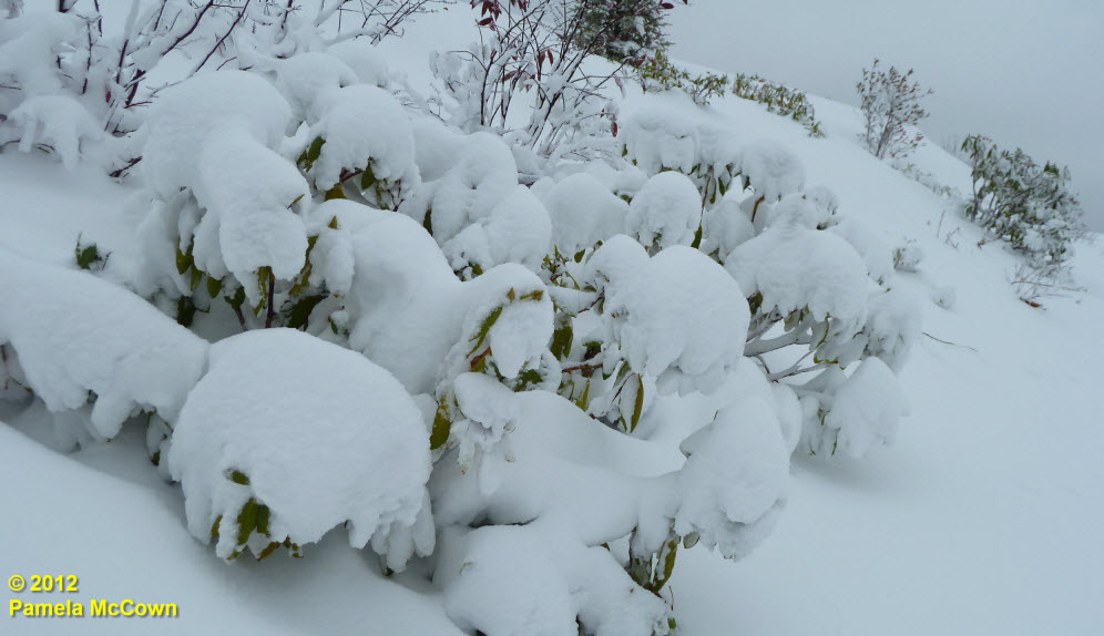
Why did the higher elevations get hammered while there was very little, if any snow in the valley? Blame a process called orographic lift. As a cold air mass approaches WNC from the north or northwest, those tall mountains along the NC/TN state line force the air mass to rise over the mountains. As the air is lifted over the mountains, it cools dramatically, saturating the air, and causing precipitation to form, usually as snow in the cold months. This effect can be very localized and often results in very high snowfall totals along and just downwind of the ridges. The result: lots of snow! This rhododendron at 4,000 feet shows the impact of what an 18 inches of snow can do.
The change to what already feels like winter in the higher elevations happened very quickly this year, as you can see in the images below.
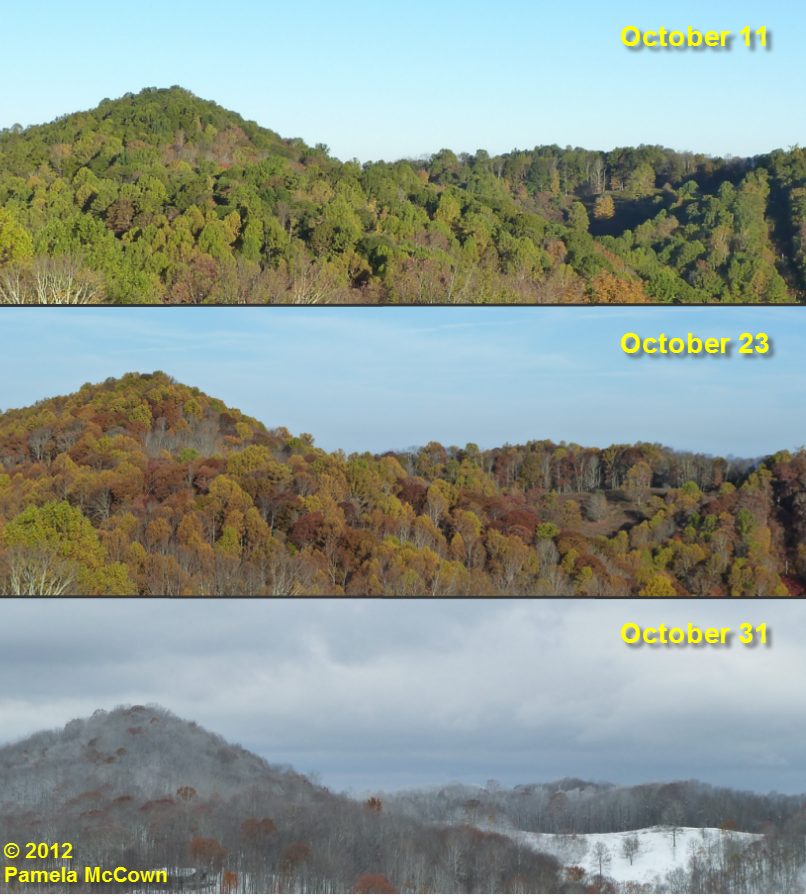
There’s nothing like experiencing three seasons in a single month!
The good news is that the early November sun and slightly warmer temperatures into the weekend should help to melt the fallen snow. The not so good news: Soon, we could get more unseasonably cold and stormy weather and we’ll have to adjust to the end of Day Light Saving Time.
Think this latest snow may be a sign of things to come? I hope you will join us next week to find out. Meteorologist Tom Ross will present the long-range winter weather forecast for WNC on Thursday, Nov. 8, at 6 p.m. at Ferguson Auditorium on the A-B Tech Asheville campus. The event is open to everyone in the community and no registration is required. Click here for more information including an informational flyer and a map.
Before you comment
The comments section is here to provide a platform for civil dialogue on the issues we face together as a local community. Xpress is committed to offering this platform for all voices, but when the tone of the discussion gets nasty or strays off topic, we believe many people choose not to participate. Xpress editors are determined to moderate comments to ensure a constructive interchange is maintained. All comments judged not to be in keeping with the spirit of civil discourse will be removed and repeat violators will be banned. See here for our terms of service. Thank you for being part of this effort to promote respectful discussion.