From the Institute for Climate Education at A-B Tech:
Most of us have seen the famous “Blue Marble” picture that was taken on December 7, 1972, by the astronauts on Apollo 17 as they were headed to the moon. The famous image, below, was taken with a hand-held camera just over five hours after launch, as the last manned lunar mission was about 2,800 miles from the Earth.

Image credit: NASA
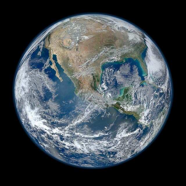
NASA has now released an amazing new view of our planet. One that highlights the advances that we’ve made in observing the Earth’s weather and climate from the satellites that orbit our planet.

Credit: NASA Click here for a high-res image (16.4MB).
The image above is not a single image taken with a camera, but a series of images taken 512 miles above the planet by the newest Earth-observing satellite launched by NASA, the Suomi National Polar-orbiting Partnership (NPP).
Launched from Vandenberg Air Force Base in California on Oct. 28, 2011, the satellite began making its first measurements in November as scientists tested the instruments. The image above was produced on Jan. 4 this year (an amazingly clear winter day across North America) by the Visible Infrared Imaging Radiometer Suite (VIIRS), one of the five scientific instruments on board.
You may remember that on that day Western North Carolina had just seen snow at the higher elevations. You can see the cloud cover with that system moving toward the Northeast U.S.in the image above. (See the January 5th Fun Facts for a view of the snow from NASA’s Terra satellite.)
As a polar-orbiting satellite, Suomi NPP rises in the south and sets in the north on the daylight side of the planet. As the Earth rotates below it, the satellite circles from south to north 512 miles overhead imaging a 1,900 mile wide swath. This allows the satellite to cover the surface of the globe in a day. But the satellite’s orbit is also sun-synchronous, meaning that it passes over the equator at the same local time on the ground. This maintains the angle between the sun and the Earth — so all images have similar lighting producing a consistent and well-lit view across the whole globe.
Suomi NPP does so much more than take beautiful images. It is the first satellite designed to collect data to improve short-term weather forecasts and to increase our understanding of long-term climate by measuring key climate variables. It is a bridge between NASA’s Earth Observing System satellites and the next generation of weather and climate observing satellites, called the Joint Polar Satellite System, a National Oceanic and Atmospheric Administration program. Data from Suomi NPP will come to NOAA’s National Climatic Data Center in Asheville.
Do you enjoy earth science, weather and climate? Join us for one of our classes! The Institute for Climate Education is registering students for the next Mountain Weather and Climate class that starts on Feb. 16. Learn more here.


Before you comment
The comments section is here to provide a platform for civil dialogue on the issues we face together as a local community. Xpress is committed to offering this platform for all voices, but when the tone of the discussion gets nasty or strays off topic, we believe many people choose not to participate. Xpress editors are determined to moderate comments to ensure a constructive interchange is maintained. All comments judged not to be in keeping with the spirit of civil discourse will be removed and repeat violators will be banned. See here for our terms of service. Thank you for being part of this effort to promote respectful discussion.