From the Institute for Climate Education at A-B Tech:

Image credit: NASA Earth Observatory image by Jesse Allen and Robert Simmon, using VIIRS Day Night Band data
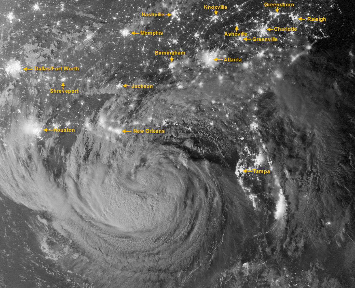
This amazing image of Tropical Storm Isaac was captured just after midnight on Tuesday, Aug. 28, by the Visible Infrared Imaging Radiometer Suite (VIIRS) on the Suomi-NPP satellite. Still off the Gulf Coast, Isaac’s clouds were lit by moonlight and the lights of cities across the Southeast U.S. are clearly visible. I’ve added labels for some of the more visible metropolitan areas, including Asheville.
At the time this image was taken, Isaac was a Tropical Storm with maximum sustained winds of 70 mph. The storm was upgraded to a hurricane just before noon on Tuesday when its winds were reported at 75 mph.
Isaac moved on shore at 7 p.m. last night (Tues, 8/28/12), and was downgraded to a Tropical Storm at 2 p.m. on Wednesday, Aug. 29. However, it is important to note that while a Category 4 or 5 hurricane seems so much more dramatic than a plain ol’ tropical storm, the real danger from these systems is often from the amount of storm surge and inland flooding that they produce. So don’t be fooled by the downgrading of the storm and its potential to do harm. (Remember what Tropical Storm Allison did to Houston in 2001?) Isaac is a very slow-moving storm and that increases the danger of flooding as it is expected to produce over 14 inches of rain in some areas.
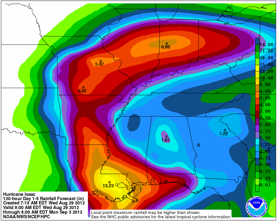
Will we see rain in Western North Carolina from Isaac? Scattered showers and thunderstorms have developed this afternoon (Wed, Aug. 29) over the area, thanks to a lingering surface front. The latest forecast from NOAA for rainfall associated with the storm, below, indicates that most of the rain will occur well to our west. The forecast below is for the total rainfall expected through Monday morning of next week, in inches. However, I encourage you to keep a watchful eye on the forecast as we head into the upcoming Labor Day weekend as we may see locally heavy rain here as well — especially in the mountains.

Click here for more information on the rainfall forecast above.
Click here for the original release by NASA Earth Observatory for more information about the satellite image.
I hope you have a great week and a very safe Labor Day weekend!


In pondering the timing and import of this
storm, I wonder if this natural event borders on
a Noah’s Ark scenario. Is the higher power trying to tell us that 1% of the population amassing the wealth in this country, leaving the other 99% impoverished, is unacceptable? Here are some facts that support my hypothesis: the advent of this hurricane was on the anniversary of Hurricane Katrina; New Orleans avoided a direct hit by this 600 mile hurricane; the water-impoverished Mississipi River will be replenished by this storm as well as drought-plagued states. Does this all not seem providential? I rest my case.
“Does this all not seem providential?”
No. It seems cyclical, and typical of the history of hurricanes. We are in the middle of hurricane season, so the timing is not at all mysterious or ‘providential’. History is full of examples of hurricanes bearing down on a particular geographical area and altering direction. And lots of rain typically does replenish depleted lakes, rivers and so forth when it falls in those places.
“Does this all not seem providential? I rest my case.”
Don’t rest yet – I confess I do not get what point you’re trying to make. Could you elaborate?