From the Institute for Climate Education at A-B Tech: After three days of rain, many locations in Western North Carolina have reported significant rainfall. Now, the larger-scale weather pattern appears to be shifting into a more winter-like pattern for the Eastern U.S., with a significant winter storm expected later today, Jan. 17, and arctic air moving in over the weekend. So, hold on: It looks like it’s going to be a bumpy ride!
Many of us got a very quick peek of sunshine around lunchtime yesterday afternoon. But that peek, while appreciated, was very short. Meteorologists call that a “sucker hole” because it can lead folks to believe that the wet weather is over. Don’t be suckered in. Our weather ride has only just begun!
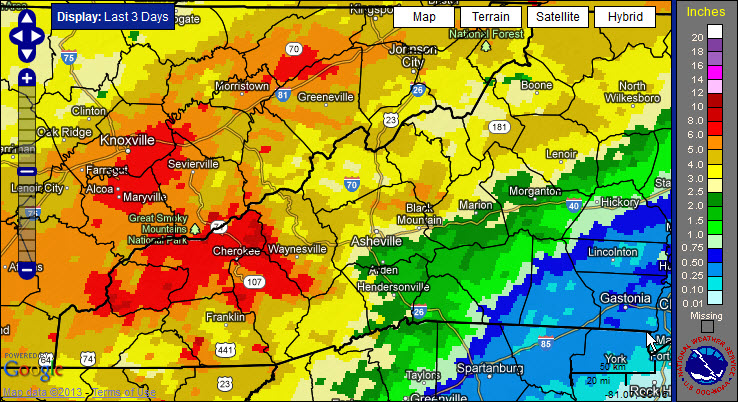
It’s not unusual to see wide variations in the amount of rain that falls over WNC. Our complex terrain is partially responsible for this variation, and you can see the complexity in the image below that shows rainfall totals over the past few days. Many locations south and east of Asheville received 2 inches or less of rain, while totals have been significantly higher north and west of Asheville. You can use the key to the right of the map to see how much rain fell in our area. (Click on the link below the image and zoom into our area to access more information.)

Image Credit: NOAA’s National Weather Service Southern Region Headquarters
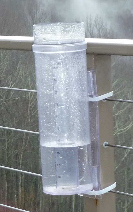
The rain gauge at my home certainly got its fair share. I haven’t emptied it yet, but this is what 3.5 – 4” of rain looks like! More rain is expected and the threat for flooding continues, especially in those areas that have seen the most rain and along creeks and rivers that are already swollen.

Be aware that the National Weather Service has issued a Jan. 17 Winter Storm Warning for our area. An area of low pressure is developing to our southeast and will move across our region tomorrow, bringing cold air and heavy wet snow into Western North Carolina during the day. This will likely cause significant issues on area roads tomorrow afternoon and evening — and yes — snow is expected in Asheville and many locations in the French Broad River Valley with the most snow expected in locations north and west of Asheville. As usual, the higher elevations will likely see the heaviest snow, with over a foot of snow possible in some places.
Make sure you stay weather alert and watch for the early closings of schools and businesses. The latest forecast brings the worst of the snow into our area during the late afternoon and early evening making for a treacherous evening rush hour. The heavy wet snow will add to the flood threat and may bring down trees, possibly causing power outages and hazards on the roads.
Be safe and prepare tonight. Much colder arctic air is expected to arrive late Sunday and into early next week. Hello, winter!


Before you comment
The comments section is here to provide a platform for civil dialogue on the issues we face together as a local community. Xpress is committed to offering this platform for all voices, but when the tone of the discussion gets nasty or strays off topic, we believe many people choose not to participate. Xpress editors are determined to moderate comments to ensure a constructive interchange is maintained. All comments judged not to be in keeping with the spirit of civil discourse will be removed and repeat violators will be banned. See here for our terms of service. Thank you for being part of this effort to promote respectful discussion.