

From the Institute for Climate Education at A-B Tech:
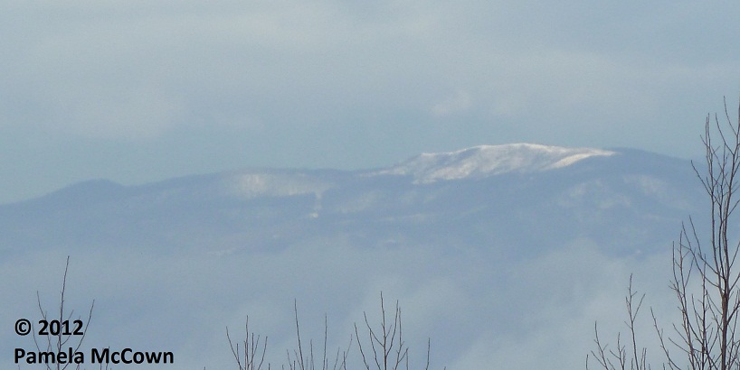
Snowflakes were flying earlier this week, as Valentine’s Day started off white at the higher elevations. This image of Max Patch in western Madison County shows the short-lived snow. So — what has happened to this winter? Why has it been so different than the last two years?
Following the harsh winters that Western North Carolina endured during the last two years, we were all waiting with some dread to see how the winter of 2011-2012 would present itself. I don’t know about you, but I’ve really enjoyed the ability to work in the yard this winter — the same yard that was covered in 3 feet of snow during the same period for the last two years!
Whether you’re enjoying the break — or are wishing for a good ol’ winter storm — we can all look to the polar vortex for hints about what has contributed to the warmer than usual winter across much of the lower 48 states. The polar vortex is a band of winds that blow counterclockwise, circling the Arctic. During some years, that band of winds is very strong and acts as a dam that keeps much of the cold air locked up over the polar regions, and out of the lower 48. So far, that’s been the situation for much of this winter.
Meteorologists track the polar vortex by watching two related oscillations in the Northern Hemisphere: the North Atlantic Oscillation (NAO) and the Arctic Oscillation (AO). Similar in some ways to El Niño and La Niña, these regular oscillations impact short-term climate, but their influence is usually limited to the Northern Hemisphere. If you are interested in learning more about these oscillations and their impact on North Carolina, the State Climate Office of North Carolina has an excellent write-up here.
For much of this winter, the NAO and AO indices have both been very “positive.” In this state, the polar vortex has kept much of the cold air locked up over the arctic region, resulting in less snow and fewer outbreaks of really cold air across the contiguous U.S. The image below shows the NAO and AO indices for the month of December for each of the last sixty years. You’ll notice that December of 2011 was strongly positive for both the NAO and the AO, but that the previous two winters were very strongly negative for both of the indices.
Do you remember a particularly bad winter over the last 60 years? Take a look and see is both the NAO and the AO were both negative. The winters of much of the 1960s are a good example.
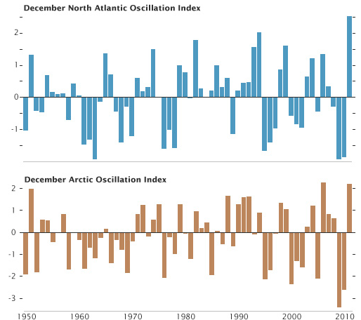
Graph by Hunter Allen (NOAA) and Robert Simmon (NASA) based on data from NOAA’s National Weather Service Climate Prediction Center.
Keep in mind: We have a long way to go until spring, and some our most impressive winter storms can still occur even into April.
In the meantime, WNC continues to enjoy above average temperatures and precipitation. However, it looks like we may see a little snow, especially in the mountains this weekend. Not too bad — for the dead of winter.
You can find all of the Institute’s Fun Facts on our website here.
January and February are the two months that I can bank on… not so this year.